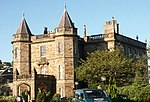
Ravelrig Junction Platform railway station

Ravelrig Junction Platform railway station or Ravelrig Halt was originally opened in 1884 as a two platform station on the Shotts line on the edge of the Dalmahoy Estate in an area that now forms part of the city of Edinburgh. It stood just to the west of Ravelrig Junction that served the Balerno Loop Line. After closure in 1920 Ravelrig Platform for Dalmahoy Golf Course was opened at the same site around 1927 as a single platform when the Dalmahoy Estate became a hotel with a golf course, however it is stated to have closed in 1930. The site may have also served a military purpose. The Balerno Loop Line had been primarily built as a goods line, with a dedicated goods station at Balerno, serving the many mills on the Water of Leith, however a passenger service was provided by the Caledonian Railway and after grouping by the London, Midland and Scottish Railway, seeing formal closure to passenger traffic shortly after nationalisation. A halt (NT151673) is indicated on the accompanying map to have existed for a short time circa 1903 on the Balerno line, 75 chains from Balerno railway station and 23 chains from Ravelrig junction. This would have been ideally located to serve the workers at the large Ravelrig quarries.
Excerpt from the Wikipedia article Ravelrig Junction Platform railway station (License: CC BY-SA 3.0, Authors, Images).Ravelrig Junction Platform railway station
Long Dalmahoy Road, City of Edinburgh
Geographical coordinates (GPS) Address External links Nearby Places Show on map
Geographical coordinates (GPS)
| Latitude | Longitude |
|---|---|
| N 55.8939 ° | E -3.3708 ° |
Address
Ravelrig Junction Platform
Long Dalmahoy Road
EH27 8EE City of Edinburgh
Scotland, United Kingdom
Open on Google Maps


