place

Bewsey

Villages in CheshireWarrington

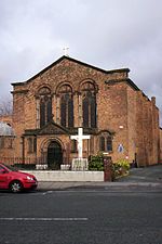
Bewsey and Whitecross is a ward to the west of the town centre of Warrington (and includes much of the town centre), in the Warrington district, in the ceremonial county of Lancashire, England. The town's General Hospital is within the ward. The area is served by the 16/16A bus route from Dallam to Warrington. Sankey Valley Park runs through Bewsey, there are community centres at Whitecross and Bewsey Park, and a community and health hub is to be built to serve the former council estates of Bewsey and Dallam. There are five primary schools, while the nearest high schools are Beamont Collegiate Academy in the Orford area, Great Sankey High School in Great Sankey, and St Gregory's RC High School.

Excerpt from the Wikipedia article Bewsey (License: CC BY-SA 3.0, Authors).

Geographical coordinates (GPS)

Latitude Longitude
N 53.3973 ° E -2.6084 °
placeShow on map

Address

Albury Close

Albury Close
WA5 0ED , Bewsey
England, United Kingdom
mapOpen on Google Maps

Share experience

Nearby Places

Manchester Ship Canal

The Manchester Ship Canal is a 36 mi-long (58 km) inland waterway in the North West of England linking Manchester to the Irish Sea. Starting at the Mersey Estuary at Eastham, near Ellesmere Port, Cheshire, it generally follows the original routes of the rivers Mersey and Irwell through the historic counties of Cheshire and Lancashire. Several sets of locks lift vessels about 60 ft (18 m) to the canal's terminus in Manchester. Landmarks along its route include the Barton Swing Aqueduct, the world's only swing aqueduct and Trafford Park, the world's first planned industrial estate and still the largest in Europe. The rivers Mersey and Irwell were first made navigable in the early 18th century. Goods were also transported on the Runcorn extension of the Bridgewater Canal (from 1776) and the Liverpool and Manchester Railway (from 1830) but by the late 19th century the Mersey and Irwell Navigation had fallen into disrepair and was often unusable. Manchester's business community viewed the charges imposed by Liverpool's docks and the railway companies as excessive. A ship canal was proposed to give ocean-going vessels direct access to Manchester. The region was suffering from the Long Depression; the canal's proponents argued that the scheme would boost competition and create jobs. They got public support for the scheme, which was first presented to Parliament as a bill in 1882. Faced with stiff opposition from Liverpool, the canal's supporters were unable to gain the necessary Act of Parliament to allow the scheme to go ahead until 1885. Construction began in 1887; it took six years and cost £15 million (equivalent to about £1.65 billion in 2011). When the ship canal opened in January 1894 (12 years after the very first meeting of the Manchester Ship Canal company) it was the largest river navigation canal in the world and enabled the new Port of Manchester to become Britain's third-busiest port despite being about 40 mi (64 km) inland. Changes to shipping methods and the growth of containerisation during the 1970s and 80s meant that many ships were too big to use the canal and traffic declined, resulting in the closure of the terminal docks at Salford. Although able to accommodate vessels from coastal ships to intercontinental cargo liners, the canal was not large enough for most modern vessels. By 2011 traffic had decreased from its peak in 1958 of 18 million long tons (20 million short tons) of freight each year to about 8 million long tons (9.0 million short tons). The canal is now privately owned by Peel Holdings, whose plans include redevelopment, expansion and an increase in shipping from 8,000 containers a year to 100,000 by 2030 as part of their Atlantic Gateway project.

Whitecross railway station

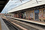
Whitecross railway station was in the Whitecross area of Warrington, England. It was built and operated by the St Helens and Runcorn Gap Railway as a temporary terminus on its line pushing east from Widnes to join with the Warrington & Stockport Railway pushing west from Altrincham. Its exact location is open to debate, as no trace remains. Tolson cites the line's inspector, Captain Wynne, as giving the Whitecross to Arpley extension as the very precise 45.75 chains (0.920 km), but as the location of the Arpley datum point is unclear then the location of Whitecross station is also precisely unclear. Tolson concludes that the station was probably 'just east of Litton Mill Crossing'. The map reference and co-ordinates used in the station data above are based on an interpretation of the map repeatedly used in the Disused Stations UK website, although that site does not include a prose section on Whitecross station. The admirably frank 8D Association site concludes "The site of this station has been completely lost with the building works that have occurred in the area we do not believe any pictures exist or that the site of the station can be located."The line through the station site continued in passenger use until 10 September 1962 when the Liverpool Lime St to Warrington via Widnes South service was withdrawn, though a lone late night Liverpool to York Postal continued to use the route until 9 September 1963, when it was diverted via Earlestown to reduce operating costs. Warrington Bank Quay Low Level remained open until 14 June 1965 but it is unclear what traffic this served along the route after the Postal was diverted. In 2015 the tracks through the station site remained heavily used, primarily by trains to and from Fiddlers Ferry Power Station, though a few other booked freights and occasional diversions used the line through to Ditton Junction.