place

Sandusky Bay

Bays of Lake ErieBays of the United StatesBodies of water of Erie County, OhioBodies of water of OhioBodies of water of Ottawa County, Ohio
Bodies of water of Sandusky County, OhioFrench-American culture in OhioSandusky, Ohio
Sandusky Bay
Sandusky Bay

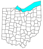
Sandusky Bay is a bay on Lake Erie in northern Ohio, formed at the mouth of the Sandusky River. It was identified as Lac Sandouské on a 1718 French map, with early variations recorded that suggest the name was derived from Native American languages. The Thomas A. Edison Memorial Bridge was constructed across it in the 20th century to connect highways in Erie and Ottawa counties.

Excerpt from the Wikipedia article Sandusky Bay (License: CC BY-SA 3.0, Authors, Images).

Geographical coordinates (GPS)

Latitude Longitude
N 41.470277777778 ° E -82.855 °
placeShow on map

Address

Erie County


Ohio, United States
mapOpen on Google Maps

Sandusky Bay
Sandusky Bay
Share experience

Nearby Places

Sandusky River
Sandusky River

The Sandusky River (Wyandot: saandusti; Shawnee: Potakihiipi ) is a tributary to Lake Erie in north-central Ohio in the United States. It is about 133 miles (214 km) long and flows into Lake Erie at the southwest side of Sandusky Bay. The Sandusky River, like the Maumee River to the west, is home to the annual walleye run in the spring, specifically March–April. The river also receives a run of white bass around the same time in the spring. The numbers of walleye that return to spawn upstream are not as great as those that return to the Maumee River. The Ballville Dam, built on the Sandusky River in Fremont, Ohio, blocked migration for walleye and other fish. As fish can swim farther upstream in the Maumee, they have access to more spawning areas and have developed a larger population than in the Sandusky River. Opponents of the dam projected that its removal would improve access for walleye and other migratory fish to areas upstream and lead to an increase in their population, as has happened on other rivers where dams have been removed. The Ballville Dam was no longer used for power generation or navigation improvements. The city of Fremont undertook a study to explore the options of tearing it down or repairing it. A 2014 study found that removal would have little adverse effect on city conditions and would strongly improve the fisheries. In 2016 voters approved taking down the dam. (Note: The Balville dam was demolished in July 2018). The river's name derives from the Wyandot words saandusti, meaning "water (within water-pools)" or from andusti, meaning "cold water". It was transliterated in various spellings by French and English colonists.