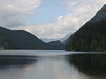
Indian Arm
Coast of British ColumbiaFjords of British ColumbiaInlets of British ColumbiaLandforms of Lower Mainland

Indian Arm (Halkomelem: səl̓ilw̓ət) is a steep-sided glacial fjord adjacent to the city of Vancouver in southwestern British Columbia. Formed during the last Ice Age, it extends due north from Burrard Inlet, between the communities of Belcarra (to the east) and the District of North Vancouver (to the west), then on into mountainous wilderness. Burrard Inlet and the opening of Indian Arm was mapped by Captain George Vancouver and fully explored days later by Dionisio Alcalá Galiano in June 1792.
Excerpt from the Wikipedia article Indian Arm (License: CC BY-SA 3.0, Authors, Images).Indian Arm
Powerhouse Road,
Geographical coordinates (GPS) Address Nearby Places Show on map
Geographical coordinates (GPS)
| Latitude | Longitude |
|---|---|
| N 49.376944444444 ° | E -122.87805555556 ° |
Address
Powerhouse Road
British Columbia, Canada
Open on Google Maps


