place

Eryholme railway station

1846 establishments in EnglandDisused railway stations in North YorkshireFormer North Eastern Railway (UK) stationsPages with no open date in Infobox stationRailway stations in Great Britain closed in 1969
Railway stations in Great Britain opened in 1846Use British English from December 2016Yorkshire and the Humber railway station stubs

Eryholme railway station, originally named as Dalton Junction, was a railway station located on the East Coast Main Line between Northallerton and Darlington in North Yorkshire, England. It was the point at which the now closed Eryholme-Richmond branch line diverged from the East Coast Main Line. Passing the site today passengers on the East Coast main Line would be hard pressed to pinpoint the location of Eryholme, as all signs of the station have been demolished. The station probably saw its greatest number of passengers during World War II as it was the drop off point for servicemen arriving at the nearby RAF Croft. After the war it was also used by railwaymen living in nearby cottages for which trains stopped there but were not advertised in the timetables. This arrangement continued until 1969 when services on the Richmond Branch were withdrawn.

Excerpt from the Wikipedia article Eryholme railway station (License: CC BY-SA 3.0, Authors).

Eryholme railway station
West Lane,

Geographical coordinates (GPS) Address Nearby Places
placeShow on map

Wikipedia: Eryholme railway stationContinue reading on Wikipedia

Geographical coordinates (GPS)

Latitude Longitude
N 54.449121 ° E -1.534181 °
placeShow on map

Address

Eryholme

West Lane
DL2 2PP , Dalton-on-Tees
England, United Kingdom
mapOpen on Google Maps

Share experience

Nearby Places

Dalton-on-Tees
Dalton-on-Tees

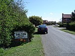
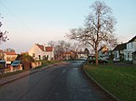
Dalton-on-Tees is a village and civil parish in the Richmondshire district of North Yorkshire, England, near the boundary with County Durham. According to the 2001 Census there were 318 people living in the parish (including Eryholme) in 120 houses. The population had decreased to 303 by the time of the 2011 Census.The village is bypassed by the A167 road between Darlington and Northallerton and is 1+1⁄2 miles (2.4 km) south of the village of Croft-on-Tees and 1 mile (1.6 km) north-east of the motor racing circuit Croft Circuit. There are signs at both the north and south entrances to the village indicating that the village is 11+1⁄4 miles (18.1 km) from Northallerton and 4+3⁄4 miles (7.6 km) from Darlington even though they are 1⁄4 mile (0.4 km) apart. To the east the village overlooks a meander of the River Tees, from which it derives its name: the town (tun) in the valley (or dæl [dale]).The village has a pub, the Chequers Inn, overlooking the village green, and a small village hall on the other side of the bypass just along West Lane. The village green is the site of the village pump (now defunct) which stands under a sprawling chestnut tree. There are a number of signed streets in the village, namely, Ruskin Close, Byron Court, Garth Terrace, Orchard Close and West Lane, and a number of unsigned roads and lanes, including The Green and the Old Road. The parish had 133 properties at the 2011 Census but new estates have been built in the village since then. Dalton-on-Tees is served by the number 72 public bus between Darlington and Northallerton and on school days the number 466R between Croft-on-Tees and Richmond School. The village has a series of moats, identified as a fishpond complex dating back to Medieval times.

Eryholme
Eryholme

Eryholme is a village and civil parish in the district of Richmondshire in North Yorkshire, England. As the population remained less than 100 in the 2011 census, information is included with that of Dalton-on-Tees.The village is situated on the south bank of the River Tees, opposite Hurworth, 4.5 miles (7.2 km) south-east of Darlington.In this part of the Tees Valley the river forms many loops called 'holmes'. The word 'holm' is of Viking origin and means "island formed by a river". Eryholme's name is, however, a corruption of its original name 'Erghum'. This name means shieling - a shelter for livestock, which comes from the Old Irish word 'airgh'. This word was introduced into Yorkshire place names by Norwegian Vikings who had lived in Ireland for a number of generations and adopted many Irish words. The Church of St Mary the Virgin in Eryholme is a grade II* listed plain sandstone building, originally built c.1200 and modified in the 13th, 14th and 16th centuries. Set inside the east wall of the porch is a small, ancient carving of a human figure. A distinct heart outline in the chest proves the identity of Christ. The notion of the sacred heart proliferated in the 13th century. This date is also consistent with the splayed tunic. Pevsner suggested it was Anglo-Danish but the sacred heart excludes this. It represents a time of burgeoning new religious philosophies from the Cistercian leader St Bernard of Clairvaux and the local Saint Godric of Finchale, who was in contact with the Cistercians and active in the Tees Valley. The registers at the church date from 1565.There are the remains of a Victorian era brick and tile works in the village. There used to be a railway station called Eryholme but it was located at Dalton-on-Tees, some 1.9 miles (3 km) south-west of the village. Passenger services ceased in 1911 but were restarted during the Second World War for personnel serving at the nearby RAF Croft.The chief activity is farming, the farms forming part of the Neasham estate owned by the Wrightson family. The village was famous for the breeding of shorthorn cattle and a cow sold to the Colling brothers became part of the original stock from which were bred the Durham Ox and Comet.