place

Palm Springs Art Museum

1938 establishments in CaliforniaArt museums and galleries in CaliforniaArt museums established in 1938Buildings and structures in Palm Springs, CaliforniaCulture of Palm Springs, California
E. Stewart Williams buildingsInstitutions accredited by the American Alliance of MuseumsModernist architecture in CaliforniaMuseums in Riverside County, CaliforniaMuseums of American artMuseums on the National Register of Historic PlacesNational Register of Historic Places in Riverside County, CaliforniaNative American museums in CaliforniaNatural history museums in CaliforniaTourist attractions in Palm Springs, California
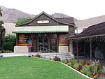
The Palm Springs Art Museum, formerly the Palm Springs Desert Museum, in Palm Springs, California LCCN2013631275

The Palm Springs Art Museum (formerly the Palm Springs Desert Museum) is a visual and performing arts institution with several locations in the Coachella Valley, in Riverside County, California, United States, founded in 1938. PSAM has been focused on design and contemporary art since 2004. PSAM houses an art museum and an Architecture and Design Center in Palm Springs, California, along with the Faye Sarkowsky Sculpture Garden at a satellite location in Palm Desert.

Excerpt from the Wikipedia article Palm Springs Art Museum (License: CC BY-SA 3.0, Authors, Images).

Palm Springs Art Museum
North Museum Drive, Palm Springs

Geographical coordinates (GPS) Address Phone number Website External links Nearby Places
placeShow on map

Wikipedia: Palm Springs Art MuseumContinue reading on Wikipedia

Geographical coordinates (GPS)

Latitude Longitude
N 33.824166666667 ° E -116.55 °
placeShow on map

Address

Palm Springs Art Museum

North Museum Drive 101
92262 Palm Springs
California, United States
mapOpen on Google Maps

Phone number

call7603224800

Website
psmuseum.org

linkVisit website

linkWikiData (Q2048123)
linkOpenStreetMap (316849790)

The Palm Springs Art Museum, formerly the Palm Springs Desert Museum, in Palm Springs, California LCCN2013631275
Share experience

Nearby Places

Cactus to Clouds Trail

The Cactus to Clouds Trail (C2C) is a hiking route in California. It begins in Palm Springs, California, and ascends to San Jacinto Peak. With a net elevation gain of roughly 10,300 feet (3,100 m), it has one of the greatest elevation increases among day-hike routes in the United States. The elevation gain happens in only 16 miles (26 km), also making it one of the steeper trails of its length in the world. The trail runs roughly parallel to the Palm Springs Aerial Tramway, and the upper part of the trail runs very close to the Mountain station of the tramway. The initial part of the route is called the Skyline Trail, which climbs 7,900 feet from the desert to Long Valley, in about 11 miles. There, it joins another system of trails, where hikers may gain another 2,400 feet (over 5 miles) to the summit. The route from the desert to the peak and back to the desert is about 32 miles long. A common way to tackle the hike is to walk the way up to the peak from the valley, then head back to the tram station, and then take the tram back down to the valley floor. Separate records are kept for the climb of Skyline Trail (first 11 miles), for C2C (16 miles one way from the museum to the peak, Cactus to Clouds), and for C2C2C (valley floor to the peak, and back to floor). A hike up this route typically starts behind the Palm Springs Art Museum. The Skyline Trail starts along a path known as the Museum Trail, continues to a junction with the North Lykken Trail, before becoming an informal trail, not maintained by government agencies. At its end, it joins the Desert View Nature Trail in Mount San Jacinto State Park. The Skyline Trail ends at Long Valley at the end of the Nature Trail. At the end of Skyline, there is a ranger station where it is sometimes possible to obtain potable water. From here, the route continues to a trail junction called Wellman Divide, before reaching the summit of San Jacinto Peak. There is a nearby cross-country mountaineering route to San Jacinto Peak, called the Snow Creek route. The approach rises even more dramatically than C2C, gaining 11,000 feet in just 7 miles.