Silver Peak (King County, Washington)

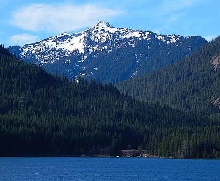
Silver Peak is a prominent 5,605 ft (1,710 m) mountain located in eastern King County of Washington state. It is set on the crest of the Cascade Range, on land managed by Mount Baker-Snoqualmie National Forest. Silver Peak is situated 4.5 miles southwest of Snoqualmie Pass, and three miles west of Keechelus Lake. The Pacific Crest Trail traverses its east flank and provides easiest access. The nearest higher neighbor is Granite Mountain, 3.98 miles (6.41 km) to the north-northwest. Precipitation runoff from the east side of the mountain drains into Cold Creek, a tributary of the Yakima River, whereas the west side of the mountain drains into the South Fork Snoqualmie River via Humpback Creek.
Excerpt from the Wikipedia article Silver Peak (King County, Washington) (License: CC BY-SA 3.0, Authors, Images).Silver Peak (King County, Washington)
Silver Peak Trail,
Geographical coordinates (GPS) Address Nearby Places Show on map
Geographical coordinates (GPS)
| Latitude | Longitude |
|---|---|
| N 47.361554 ° | E -121.461288 ° |
Address
Silver Peak Trail
Silver Peak Trail
Washington, United States
Open on Google Maps


