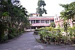
Kalyani, West Bengal

Kalyani is a planned urban city in Nadia district in the Indian state of West Bengal. It is also a municipality and Community Development Block in Nadia. It is located around 50 kilometres (31 miles) from Kolkata — the capital of West Bengal. Kalyani is the administrative headquarters of Kalyani subdivision. It resides on the eastern banks of Hooghly River, and is part of the Kolkata Metropolitan Development Authority (KMDA). During the period of World War II, the surroundings of the then Chandamari village was purportedly used as an air base by the United States Army Air Forces, and was known by the name of "Roosevelt Town" or "Roosevelt Nagar", after then US President Franklin D. Roosevelt. Later, after the surrender of Japan and the independence of India, the air base was abandoned. On the same area, a planned town named "Kalyani" was developed by the Government of West Bengal in 1951 on the behest of Bidhan Chandra Roy – the second Chief Minister of West Bengal – for hosting the Indian National Congress meeting and to accommodate the housing needs of the growing population of Calcutta. Kalyani, being a planned town, is characterized by underground sewage system, paved roads forming rectangular grids, tree-lined avenues and community parks. Kalyani has a dedicated industrial zone including Andrew Yule and Company, Kalyani Breweries (UB Group), Black Label beer and Dabur, TDK-EPCOS, though many of the industries have either closed or stopped production. It is an important centre of education in West Bengal, with two universities (University of Kalyani and Bidhan Chandra Krishi Viswavidyalaya), IISER, IIIT Kalyani, All India Institute of Medical Sciences, Kalyani, College of Medicine & JNM Hospital, Kalyani Government Engineering College and other institutes of higher education and research. Kalyani Stadium has emerged as an alternative location to Kolkata for holding numerous I-League football matches and other sporting events. The Bengal Cricket Academy and a stadium have been established by Cricket Association of Bengal in Kalyani for promotion and development of cricket.
Excerpt from the Wikipedia article Kalyani, West Bengal (License: CC BY-SA 3.0, Authors, Images).Kalyani, West Bengal
SH1, Kalyani City B-6
Geographical coordinates (GPS) Address Nearby Places Show on map
Geographical coordinates (GPS)
| Latitude | Longitude |
|---|---|
| N 22.975 ° | E 88.434444444444 ° |
Address
SH1
741235 Kalyani City, B-6
West Bengal, India
Open on Google Maps


