Kendall Peak

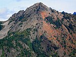
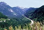
Kendall Peak is a mountain located on the county line separating King County and Kittitas County of Washington state. It is within the Alpine Lakes Wilderness on the crest of the Cascade Range. Kendall Peak is situated two miles northeast of Snoqualmie Pass on land managed by Mount Baker-Snoqualmie National Forest. Precipitation runoff on the east side of the mountain drains into Silver Creek and makes its way to the Columbia River via Yakima River, whereas the west side of the mountain drains into the South Fork Snoqualmie River via Commonwealth Creek. The Pacific Crest Trail traverses its west flank and an exposed section of the trail called Kendall Katwalk has seen tragic deaths over the years, most recently September 5, 2018. The nearest higher peak is Red Mountain, 0.9 miles (1.4 km) to the north-northwest.
Excerpt from the Wikipedia article Kendall Peak (License: CC BY-SA 3.0, Authors, Images).Kendall Peak
Pacific Crest National Scenic Trail,
Geographical coordinates (GPS) Address Nearby Places Show on map
Geographical coordinates (GPS)
| Latitude | Longitude |
|---|---|
| N 47.443098 ° | E -121.384853 ° |
Address
Pacific Crest National Scenic Trail
Pacific Crest National Scenic Trail
98068
Washington, United States
Open on Google Maps


