Chiemgau
Bavaria geography stubsCultural landscapes of GermanyUpper Bavaria

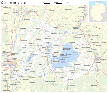
Chiemgau (German pronunciation: [ˈkiːmɡaʊ]) is the common name of a geographic area in Upper Bavaria. It refers to the foothills of the Alps between the rivers Inn and Traun, with the Chiemsee at its center. The political districts that contain the Chiemgau are Rosenheim and Traunstein. Wendelstein is the name of a famous mountain close by but not strictly in the Chiemgau, while Kampenwand is actually the most inviting peak south of Chiemsee.
Excerpt from the Wikipedia article Chiemgau (License: CC BY-SA 3.0, Authors, Images).Chiemgau
Hackenstraße,
Geographical coordinates (GPS) Address Nearby Places Show on map
Geographical coordinates (GPS)
| Latitude | Longitude |
|---|---|
| N 47.816666666667 ° | E 12.433333333333 ° |
Address
Hackenstraße
83236
Bavaria, Germany
Open on Google Maps


