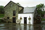
Pentreheyling
AC with 0 elementsShropshire geography stubsVillages in Shropshire

Pentreheyling is a hamlet in Shropshire, England. It lies just west of Brompton on the A489 between Church Stoke and Newtown. The hamlet is notable for the fact that it is impossible to reach any other settlement in England (except Brompton) by road without first passing through Wales. Public footpaths are the only access which links it with the rest of England. It is however not geographically an exclave. Pentreheyling is in the civil parish of Chirbury with Brompton; formerly in the parish of Brompton and Rhiston. The remains of a Roman fort have been discovered in the hamlet.
Excerpt from the Wikipedia article Pentreheyling (License: CC BY-SA 3.0, Authors, Images).Pentreheyling
A489,
Geographical coordinates (GPS) Address Nearby Places Show on map
Geographical coordinates (GPS)
| Latitude | Longitude |
|---|---|
| N 52.529 ° | E -3.117 ° |
Address
A489
SY15 6HU , Kerry
Wales, United Kingdom
Open on Google Maps


