place

Hoʻomaluhia Botanical Garden

1982 establishments in HawaiiHawaii geography stubsHonolulu Botanical GardensProtected areas established in 1982Protected areas of Oahu
United States garden stubs
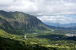
Ho'omaluhia Botanical Garden tree view

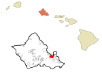
The Hoʻomaluhia Botanical Garden (approximately 400 acres) is a botanical garden located at 45–680 Luluku Road, Kāne'ohe, Oahu, Hawaii. It is part of the Honolulu Botanical Gardens, and is open daily, without charge, except for Christmas Day and New Year's Day. The garden was established in 1982, and designed and built by the United States Army Corps of Engineers for flood protection. It is a rainforest garden, with plantings from major tropical regions around the world, grouped into distinct collections that focus on Africa, Hawaii, India and Sri Lanka, Malaysia, Melanesia, the Philippines, Polynesia, and the tropical New World. Special emphasis is placed on conserving plants native to Hawaii and Polynesia, as well as arecaceae, aroids, and heliconias. The garden includes a lake (32 acres) and walking trails, as well as a day use area, campgrounds, and a visitor center with lecture room, exhibition hall, workshop, and botanical library.

Excerpt from the Wikipedia article Hoʻomaluhia Botanical Garden (License: CC BY-SA 3.0, Authors, Images).

Hoʻomaluhia Botanical Garden
Park Access Road, Kaneohe

Geographical coordinates (GPS) Address Nearby Places
placeShow on map

Wikipedia: Hoʻomaluhia Botanical GardenContinue reading on Wikipedia

Geographical coordinates (GPS)

Latitude Longitude
N 21.387777777778 ° E -157.80805555556 °
placeShow on map

Address

Pa Launa

Park Access Road
96744 Kaneohe
Hawaii, United States
mapOpen on Google Maps

Ho'omaluhia Botanical Garden tree view
Share experience

Nearby Places

Hawaii Loa College
Hawaii Loa College

Hawaiʻi Loa College was a private, four-year, liberal arts college in Kaneohe, Hawaii, founded in 1963 as Christian College of the Pacific by a consortium of four Protestant church denominations in Hawaii, with land deeded by Harold K.L. Castle on which to build a campus. The idea originated with Rev. Harry S. Komuro, then superintendent of the Methodist Mission in Hawaii, and the founding trustees were Dr. Joseph Bevilacqua, general secretary of the United Church of Christ; Rev. Frank E. Butterworth, pastor of First United Methodist Church of Honolulu; Bishop Harry S. Kennedy of the Episcopal Diocese of Hawaii; and Dr. William E. Phifer, Jr., pastor of First Presbyterian Church of Honolulu. Other early trustees included Herbert Choy, Frank Damon, Jr., Dr. Wesley Hotchkiss, Ernest K. Kai, and Ted Tsukiyama.In September 1964, the name was changed to Hawaii Loa College (HLC), a new logo was chosen, and a new motto was adopted: ʻAʻole i kaupoʻo i kaupoʻo ana no ("My height is not yet reached"). A master planning committee was also formed and an architect hired to plan the new campus on 150 acres (0.61 km2) of scenic former Kaneʻohe Ranch land on the Windward side of Oʻahu, looking up at the Koʻolau Range directly beneath the Pali Lookout. The committee chair was Bruce McCandless and the architect was William L. Pereira & Associates.In May 1965, the trustees hired the college's first president, Chandler W. Rowe, former dean of academic affairs at Lawrence University, who began assembling a faculty and administrative staff in order to be able to accept the first students in the fall 1967. Until the Windward campus opened in the fall of 1971, the school borrowed facilities on the campus of Chaminade University of Honolulu (1967–68), then at 2345 Nuʻuanu Avenue (1969–70) nearer downtown Honolulu. By 1970, the senior class numbered 27 students.Later presidents include HLC philosophy professor Philip J. Bossert (1978–86) and University of Denver chancellor emeritus Dwight M. Smith (1990–92).The beautiful rural campus site was both a blessing and a curse. Lack of infrastructure made it very difficult to expand campus facilities to serve more students and raise more revenue, making operations a constant financial struggle. By 1992, Money magazine ranked HLC number 13 in the west among America's best college buys. However, in that same year, faced with loss of accreditation and saddled with $3 million in debt, Hawaiʻi Loa College merged with Hawaiʻi Pacific University.

Haiku Valley

Haʻikū Valley is an amphitheater-shaped valley on the windward side of the Koʻolau Range behind Kāneʻohe, Oʻahu in the Hawaiian Islands. The valley was the site of a United States Navy radio transmitting station (later taken over by the Coast Guard as an OMEGA Navigation System station) and is part of the route of Hawaii's Interstate H-3.The Haʻikū Stairs (also known as "Stairway to Heaven") is a foot trail of over 3,000 metal stairs ascends to Puʻu Keahiakahoe, a 2,800-foot (850 m) peak above the east valley wall. The stairs were originally constructed as a means of reaching the radio antenna attachment points high on the surrounding ridge line. The trail starts at an elevation of 480 feet (150 m) and covers an approximate horizontal distance of 4,500 feet (1,400 m) for an average slope of about 30 degrees (however, some sections are nearly vertical). The Haʻikū Stairs are closed to the public, although people still illegally trespass to experience the nearly two-hour climb. The facility initially was built following the attack on Pearl Harbor as a means of communicating with U.S. Navy ships as far away as Tokyo Bay. The facility had a massive antenna system consisting of five massive cable antennas draped from atop one mountain ridge, and across the mountain valley to the top of the other ridge. The ridges formed a horseshoe shape around the valley. The natural height of the mountain ridges made for an excellent means of having an elevated antenna system. The construction and use of the facility was initially a classified military secret.The walls of the main building were over 5 feet (1.5 m) thick and made of concrete. The building was designed to withstand a 500 lb. bomb being dropped on the top of the building, allowing people inside to survive.

Kaneohe Ranch Building

The Kaneohe Ranch Building at Castle Junction, where the Pali Highway (Route 61), Kamehameha Highway (Route 83), and Kalanianaʻole Highway (Route 72) intersect on the windward side of Oʻahu, was built in 1940 to be the headquarters of Kaneohe Ranch, which owned 12,000 acres (49 km2) of surrounding land and played a major role in the history of Kāneʻohe and Kailua. The building is significant both for its association with the Ranch and for its Hawaiian style architecture designed by Albert Ely Ives (1898-1966). Ives' other work on the windward side includes Plantation Estate which is the Winter White House of Barack Obama. The building was added to the National Register of Historic Places on 5 June 1987.The building exhibits key features of the style of Hawaiian architecture that developed during the 1920s and 1930s: the double-pitched Dickey roof with overhanging eaves, plaster-covered masonry walls, and ample cross-ventilation. Its architect was best known for his residential work; this is one of his few commercial buildings.During the mid-19th century, most of the land in the area belonged to Kalama, Queen Consort of Kamehameha III and later Queen Dowager of the Kingdom of Hawaiʻi. She and Judge Charles Coffin Harris began a sugarcane plantation on the land, but after she died in 1870 and it failed in 1871, the land eventually passed to Harris's daughter, Nannie H. Rice, who in 1893 leased 15,000 acres (61 km2) to J. P. Mendonca, who founded Kaneohe Ranch in 1894. Lower-lying wetlands were leased to Chinese rice farmers. In 1907 James Bicknell Castle became the principal stockholder of the Ranch, and 1917 his son, Harold K.L. Castle, purchased the land from Mrs. Rice. Most of the land was used for cattle-ranching until World War II, when the military took over much of it. After the war, former ranch lands have provided room for ever expanding residential subdivisions.