place

Vancouver College

1922 establishments in British ColumbiaBoys' schools in CanadaCatholic secondary schools in British ColumbiaCongregation of Christian Brothers secondary schoolsEducational institutions established in 1922
Elementary schools in VancouverHigh schools in VancouverPrivate schools in British Columbia

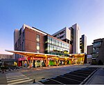
Vancouver College (abbreviated informally to VC) is an independent university-preparatory Catholic school for boys located in the Shaughnessy neighbourhood of Vancouver, British Columbia, Canada. Founded in 1922, it is the only independent Catholic all-boys school in British Columbia. Despite the school's Catholic denomination, it is open to students of all religions.

Excerpt from the Wikipedia article Vancouver College (License: CC BY-SA 3.0, Authors).

Vancouver College
Cartier Street, Vancouver Shaughnessy

Geographical coordinates (GPS) Address External links Nearby Places
placeShow on map

Wikipedia: Vancouver CollegeContinue reading on Wikipedia

Geographical coordinates (GPS)

Latitude Longitude
N 49.2363 ° E -123.1359 °
placeShow on map

Address

Vancouver College

Cartier Street
V6M Vancouver, Shaughnessy
British Columbia, Canada
mapOpen on Google Maps

linkWikiData (Q7914145)
linkOpenStreetMap (61738374)

Share experience

Nearby Places

South Granville, Vancouver

Established in 1997, South Granville (or less commonly "Uptown") is an upscale Business Improvement Area (BIA) and neighbourhood south of Vancouver's downtown core, centred along Granville Street and bordered by the neighbourhoods of Kitsilano, Fairview and Shaughnessy. Separated from Downtown by False Creek, the area runs along Granville Street from the south side of the Granville Street Bridge up to 16th Ave, where storefronts are replaced by the residences and hedges of Shaughnessy. 1907 has been decided as the unofficial birth year of the neighbourhood. In that year Richard Marpole drew up plans for Shaughnessy Heights, the Canadian Pacific Railway's newest subdivision south of 16th Ave, pitched as an alternative to the then-upscale West End ("Blueblood Alley"). This is now known as "First Shaughnessy", or simply Shaughnessy. That same year, what was once Centre Street was given its present name, Granville Street, as the portion north of the bridge already bore that name. In 2007, the South Granville BIA commemorated the neighbourhood's centennial by encasing a state-of-the-art, stainless steel time capsule in concrete and stone under the entrance of the historic Stanley Theatre. As well as being a fast-growing neighbourhood of residences, shops and restaurants, South Granville is home to a vibrant arts and culture scene. The neighbourhood contains a strip, between Broadway and the foot of the Granville Bridge, known as "Gallery Row" which is home to a number of art galleries: Bau-Xi Gallery, Douglas Reynolds Gallery, Ian Tan Gallery, Petley Jones Gallery, Uno Langmann. The South Granville Gallery Association (SGGA) represents the leading fine art galleries on Gallery Row. Further south, the neighbourhood is home to the historic Stanley Theatre, built in 1931. Once a popular cinema in its early days, the Stanley Theatre is now the stage of the Arts Club Theatre Company and the Industrial Alliance Stage.

Shaughnessy, Vancouver

Shaughnessy is an almost-entirely residential neighbourhood in Vancouver, British Columbia, Canada, spanning about 447 hectares in a relatively central locale. It is bordered by 16th Avenue to the north, 41st Avenue to the south, Oak Street to the east, and East Boulevard to the west. The older section of the neighbourhood, called "First Shaughnessy," is considered more prestigious and is bordered by 16th Avenue to the north, King Edward Avenue to the south, Oak Street to the east, and East Boulevard to the west. In 2016, the population was approximately 8,810. It was named after Thomas Shaughnessy, 1st Baron Shaughnessy, former president of the Canadian Pacific Railway. The neighbourhood's residents have an average annual household income of $111,566 ($777,184 in Shaughnessy Heights) and the average house price is $2.89 million, the highest in Vancouver. It is also the site of many historical homes, especially in First Shaughnessy. Of the neighbourhood's homes 51.5% were built before or during World War II, compared with 20.8% for the city at large. This is largely due to the 1981 First Shaughnessy Official Development Plan by-law, which promotes private property ownership and single-family dwelling, while limiting property subdivision and population density.The neighbourhood was created in 1907 by the Canadian Pacific Railway, the largest real estate developer in Canada. It was meant as an alternative to the West End, which was the traditional home for the budding city's elite. Thanks to aggressive marketing by the railway, highly regulated development, and a stronger degree of exclusiveness, it gradually took the latter's status over the past century. Shaughnessy is known for its elegant tree-lined streets and large properties. In First Shaughnessy, Angus Drive and Osler Street have a tree-lined median in addition to the trees along the edge of the road. Shaughnessy is home to Little Flower Academy, Vancouver College, and York House School. The public elementary schools are Shaughnessy Elementary and Quilchena Elementary. There is one public high school in Shaughnessy, Point Grey Secondary. The neighbourhood is in the catchment area of each of Eric Hamber Secondary School, in Oakridge, or Prince of Wales Secondary School, in Arbutus Ridge. Shaughnessy has five parks, including Shaughnessy Park, formally known as Crescent Park, and Angus Park in First Shaughnessy. The other three parks in Shaughnessy are Devonshire Park, Kerrisdale Park, and VanDusen Botanical Garden, located between 33rd and 41st Avenues. The Arbutus Greenway, purchased by the City of Vancouver from Canadian Pacific Railway, stretches along the western border of Shaughnessy from 41st Avenue to 16th Avenue.