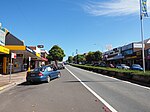
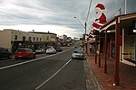
Mollymook Beach, New South Wales
City of ShoalhavenCoastal towns in New South WalesSouth Coast, New South Wales geography stubsTowns in New South WalesTowns in the South Coast (New South Wales) ... and 1 more
Use Australian English from August 2019

Mollymook Beach is a suburb in the City of Shoalhaven, New South Wales, Australia. It is located about four km north of Ulladalla on the northern end of Mollymook beach on the shore of the Tasman Sea. At the 2016 census, it had a population of 2,447. It is a mostly residential area incorporating Bannister Headland and is located north of Mollymook, with the eastern part of the border formed by Blackwater Creek. The southern part of the beach lies in Mollymook.
Excerpt from the Wikipedia article Mollymook Beach, New South Wales (License: CC BY-SA 3.0, Authors, Images).Mollymook Beach, New South Wales
Park View Parade, Shoalhaven City Council
Geographical coordinates (GPS) Address Nearby Places Show on map
Geographical coordinates (GPS)
| Latitude | Longitude |
|---|---|
| N -35.323888888889 ° | E 150.47388888889 ° |
Address
Park View Parade
Park View Parade
2539 Shoalhaven City Council, Mollymook Beach
New South Wales, Australia
Open on Google Maps


