Razing of Friesoythe

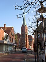
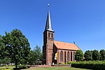
The razing of Friesoythe was the destruction of the town of Friesoythe in Lower Saxony on 14 April 1945, during the Western Allies' invasion of Germany towards the end of World War II in Europe. The 4th Canadian (Armoured) Division attacked the German-held town of Friesoythe, and one of its battalions, The Argyll and Sutherland Highlanders of Canada, captured it. During the fighting, the battalion's commander was killed by a German soldier, but it was incorrectly rumoured that he had been killed by a civilian. Under this mistaken belief, the division's commander, Major-General Christopher Vokes, ordered that the town be razed in retaliation and it was substantially destroyed. Twenty German civilians died in Friesoythe and the surrounding area during the two days of fighting and its aftermath. Similar, if usually less extreme, events occurred elsewhere in Germany as the Allies advanced in the closing weeks of the war. The rubble of the town was used to fill craters in local roads to make them passable for the division's tanks and heavy vehicles. A few days earlier, the division had destroyed the centre of Sögel in another reprisal and also used the rubble to make the roads passable. Little official notice was taken of the incident and the Canadian Army official history glosses over it. It is covered in the regimental histories of the units involved and several accounts of the campaign. Forty years later, Vokes wrote in his autobiography that he had "no great remorse over the elimination of Friesoythe".
Excerpt from the Wikipedia article Razing of Friesoythe (License: CC BY-SA 3.0, Authors, Images).Razing of Friesoythe
Lange Straße,
Geographical coordinates (GPS) Address Nearby Places Show on map
Geographical coordinates (GPS)
| Latitude | Longitude |
|---|---|
| N 53.020555555556 ° | E 7.8586111111111 ° |
Address
Lange Straße 1a
26169
Lower Saxony, Germany
Open on Google Maps


