Hereford Square
1845 establishments in EnglandBrompton, LondonCommunal gardensGrade II listed buildings in the Royal Borough of Kensington and ChelseaGrade II listed houses in London ... and 3 more
Houses completed in the 19th centuryLondon road stubsStreets in the Royal Borough of Kensington and Chelsea

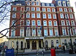
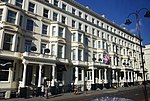
Hereford Square is a garden square in South Kensington, London SW7. It lies to the west of Gloucester Road, which forms the east side of the square. Wetherby Place is the western continuation, running off the north-west corner of the square. 10–23 and 27–35 Hereford Square have been listed Grade II on the National Heritage List for England since November 1984.The private communal gardens in the centre of Hereford Square are 0.3692 hectares (0.912 acres) in size.The garden was used as a baseball field during World War II by American soldiers.
Excerpt from the Wikipedia article Hereford Square (License: CC BY-SA 3.0, Authors, Images).Hereford Square
Hereford Square, London Brompton (Royal Borough of Kensington and Chelsea)
Geographical coordinates (GPS) Address Nearby Places Show on map
Geographical coordinates (GPS)
| Latitude | Longitude |
|---|---|
| N 51.492391666667 ° | E -0.18150555555556 ° |
Address
Hereford Square Garden
Hereford Square
SW7 4NB London, Brompton (Royal Borough of Kensington and Chelsea)
England, United Kingdom
Open on Google Maps


