place

Kőbánya-Kertváros

Budapest geography stubsKőbánya

Kőbánya-Kertváros (English: "Quarry-Garden suburb") is a section of Budapest, Hungary. The area has a largely working class population, most of whom are ethnic Hungarians. in this part of the city, there is a small ethnically Roma (Gipsy) presence to be found. There is also smaller groups of immigrants, notably Asians around the Pest side of Budapest. The garden suburb was established in 1934, improved in the 1980s. In the 1930s and 1940s it called Gömbös-telep (lit. Gömbös Estate, after Gyula Gömbös), later Városszéli telep (lit. "Estate by the city boundary").

Excerpt from the Wikipedia article Kőbánya-Kertváros (License: CC BY-SA 3.0, Authors).

Kőbánya-Kertváros
Hárslevelű utca, Budapest Kőbánya-Kertváros

Geographical coordinates (GPS) Address Phone number Website Nearby Places
placeShow on map

Wikipedia: Kőbánya-KertvárosContinue reading on Wikipedia

Geographical coordinates (GPS)

Latitude Longitude
N 47.4849 ° E 19.2042 °
placeShow on map

Address

AkváriumPlus webáruház

Hárslevelű utca 22
1106 Budapest, Kőbánya-Kertváros
Hungary
mapOpen on Google Maps

Phone number

call+36703266002

Website
akvariumplus.hu

linkVisit website

Share experience

Nearby Places

Üllői út
Üllői út

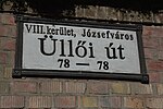
Üllői út (Üllői Avenue, lit. means "Road to Üllő", Hungarian pronunciation: [ˈylːøːji ˈuːt]) is a major transport artery in Budapest, Hungary. Üllői út is the longest avenue in Budapest. It is 15.6 km long and nearly perfectly straight. It starts at the edge of Inner City proper, crosses Small Boulevard and Grand Boulevard and runs as far as the boundary of the capital in southeastern direction, reaching the nearby towns (suburbs) of Vecsés and Üllő, the latter providing its name. During the socialist era, the avenue's name was Vörös Hadsereg útja (lit. Street of the Red Army) between Határ út (pre-1950 city limit) and the present (post-1950) city limit. See also: Greater Budapest The Metro 3 runs under it from Kálvin tér as far as Határ út, having 8 stations along it. It has a side-road leading to Ferihegy Airport, the most important international airport of Hungary. It also forms the boundary between Ferencváros and Józsefváros. Üllő means "anvil" in Hungarian. Among its notable points are Semmelweis University Museum of Applied Arts Semmelweis University Clinics Szent István Hospital and Szent László Hospital (together Üllői Avenue Clinics, the largest hospital complex in Budapest) Stadion Albert Flórián (former Üllői úti stadion/Stadion Üllői Avenue) People's Park with the central autobus station Attila József microdistrict (built 1957–1967), the first Soviet-style housing estate in Budapest Wekerletelep, a historic garden suburb built before and around WWI, named after Sándor Wekerle, its central square planned by the architect Károly Kós.