Kulm (Saalfeld)
Mountains and hills of ThuringiaMountains under 1000 metresSaalfeld-Rudolstadt

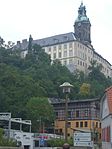
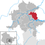
The Kulm is a hill, 481.9 m above sea level (NHN), near Saalfeld in the German state of Thuringia. It lies east of the Saale valley at the western tip of the Saale 'Knee' and is the local hill of the towns of Saalfeld and Rudolstadt. From the Kulm there is a panoramic view over the valleys of the Saale and Rinne, the Orla Basin, the Thuringian Highland and the Ilm-Saale Plateau. Near the Kulm are the villages of Schloßkulm and Dorfkulm, which belong to the municipalities of Uhlstädt-Kirchhasel and Unterwellenborn respectively.
Excerpt from the Wikipedia article Kulm (Saalfeld) (License: CC BY-SA 3.0, Authors, Images).Kulm (Saalfeld)
Ortsstraße, Kamsdorf
Geographical coordinates (GPS) Address Nearby Places Show on map
Geographical coordinates (GPS)
| Latitude | Longitude |
|---|---|
| N 50.68357 ° | E 11.36958 ° |
Address
Kulmturm
Ortsstraße
07333 Kamsdorf
Thuringia, Germany
Open on Google Maps


