place

Westonzoyland

Civil parishes in SomersetMonmouth RebellionSomerset LevelsStructures on the Heritage at Risk registerVillages in Sedgemoor
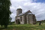
Westonzoylandchurch
Westonzoylandchurch

Westonzoyland is a village and civil parish in Somerset, England. It is situated on the Somerset Levels, 4 miles (6.4 km) south east of Bridgwater.

Excerpt from the Wikipedia article Westonzoyland (License: CC BY-SA 3.0, Authors, Images).

Westonzoyland
Main Road,

Geographical coordinates (GPS) Address Nearby Places
placeShow on map

Wikipedia: WestonzoylandContinue reading on Wikipedia

Geographical coordinates (GPS)

Latitude Longitude
N 51.106 ° E -2.923 °
placeShow on map

Address

Main Road

Main Road
TA7 0ED
England, United Kingdom
mapOpen on Google Maps

Westonzoylandchurch
Westonzoylandchurch
Share experience

Nearby Places

Monmouth Rebellion
Monmouth Rebellion

The Monmouth Rebellion, also known as the Pitchfork Rebellion, the Revolt of the West or the West Country rebellion, was an attempt to depose James II, who in February 1685 succeeded his brother Charles II as king of England, Scotland and Ireland. A group of dissident Protestants led by James Scott, 1st Duke of Monmouth, eldest illegitimate son of Charles II, opposed James largely due to his Catholicism. The failure of Parliamentary efforts to exclude James from the succession in 1681 resulted in the 1683 Rye House Plot to assassinate Charles II and James; although Monmouth was then in exile in the Dutch Republic, he was identified as a co-conspirator. His rebellion was coordinated with a simultaneous rising in Scotland, led by Archibald Campbell, 9th Earl of Argyll. On 11 June 1685, Monmouth landed at Lyme Regis in South West England where he had widespread popular support, planning to take control of the area and march on London. In the next few weeks, his growing army of nonconformists, artisans and farm workers fought a series of skirmishes with local militias and regular soldiers commanded by Louis de Duras, 2nd Earl of Feversham, and John Churchill. However, his recruits were unable to compete with the regular army and failed to capture the city of Bristol. The rebellion ended with his defeat at the Battle of Sedgemoor on 6 July 1685 by a government army commanded by Feversham and Churchill. Monmouth was beheaded for treason on 15 July 1685. Many of his supporters were tried during the Bloody Assizes, led by Judge Jeffreys, and were condemned to death or transportation. James II consolidated his power and reigned until 1688, when he was deposed by another nephew, William III of Orange, in the Glorious Revolution.

Northmoor Green
Northmoor Green

Northmoor Green is a village in south central Somerset, England, that is more commonly known as Moorland, and sometimes mistakenly called Fordgate even though it is a separate hamlet. These places being hamlets of Moorland in the civil parish of North Petherton. It is the only village in the United Kingdom with two official names on an OS Map (Northmoor Green or Moorland) Set in the heart of the Somerset levels it has the River Parrett running next to it. It has fewer local amenities than it used to; the village shop, school and post office have closed leaving only a church, village hall and an out of village pub, The Thatchers Arms. The church of St Peter and St John was built in the 1840s.The Village Hall was built to celebrate the coronation of Queen Elizabeth II. It was originally started by the villagers themselves, but had to be pulled down and rebuilt by professional builders, as the walls were not straight. Dances used to be held in it once a month, with refreshments provided by the local Women's Institutes. Before the hall was built, a small amateur dramatic society, The Parrett Players, produced two one-act plays which were held in the local school. The village gained nationwide recognition in February 2014 due to extensive flooding on the Somerset Levels which particularly affected Moorland, when the Environment Agency constructed an earth bank to try to hold back the water. Moorland Court Farmhouse was built in the early 19th century. It is a Grade II listed building. Winslade Farmhouse which is also listed dates from the 17th century, as does Moorland Cottage.North Moor to the south of the village is a 676.3 hectare biological Site of Special Scientific Interest. The low-lying area is drained by a series of ditches and the Northmoor Pumping Station.Serious flooding occurred during the Winter flooding of 2013–14 on the Somerset Levels. The Church of St Peter and St John was closed for two years following the flooding and reopened in January 2016.