place

Yr Arddu (North)

Mountains and hills of Conwy County BoroughMountains and hills of SnowdoniaWales geography stubs
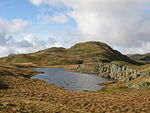
Yr Arddu geograph.org.uk 151154

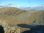
Yr Arddu is a mountain summit found in the Moelwynion in Snowdonia; grid reference SH673507. The height of the summit above sea level is 589 meters (1932 ft). The height was measured and confirmed on March 10, 2007. This summit should not be confused with Yr Arddu (South).

Excerpt from the Wikipedia article Yr Arddu (North) (License: CC BY-SA 3.0, Authors, Images).

Geographical coordinates (GPS)

Latitude Longitude
N 53.04 ° E -3.98 °
placeShow on map

Address

Cwm Edno


LL55 4NW , Dolwyddelan
Wales, United Kingdom
mapOpen on Google Maps

Yr Arddu geograph.org.uk 151154
Share experience

Nearby Places

Rhosydd quarry
Rhosydd quarry

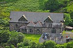
Rhosydd quarry was a slate quarry in the Moelwyn mountains, northeast of Porthmadog in North Wales. Small-scale working of the site began in the 1830s, but was hampered by the remote location, and the lack of a transport system to carry the slates to markets. The Rhosydd Slate Company was formed in 1853, and became a limited company in 1856. Transport was made more difficult by the attitude of the Cwmorthin quarry, through whose land the most obvious route to the Ffestiniog Railway ran. A solution was found in 1864, with the opening of the Croesor Tramway, to which the quarry was connected by one of the longest single-pitch cable-hauled inclines in Wales. Huge amounts of money were spent on development work, and the company, unable to make adequate returns, went into voluntary liquidation in 1873. The quarry was auctioned in 1874, and the New Rhosydd Slate Quarry Company Ltd. was formed. Unlike its predecessor, the directors were all Welsh, and three-quarters of the shareholders were also from the local area. The quarry prospered for a while, but then profitability declined, and in 1900, a large section of the underground workings collapsed. The job of opening up new areas was spearheaded by Evan Jones, who nearly succeeded, but was hampered by a slump in the slate industry and the onset of the First World War, when the quarry was "non-essential" and was mothballed. It reopened in 1919, but was in a poor financial position, and was bought by members of the Colman family, better known for producing mustard. They kept it running until 1930, but failed to find markets for the finished product. It was mothballed until 1947, when it was sold, but new plans to reopen it failed, and the pumps were turned off in 1948, after scrapmen had removed much of the machinery. Of the five slate veins in the region of Blaenau Ffestiniog, most of Rhosydd's output was extracted from the Old Vein. The workings started at the West Twll, where the rock outcropped, but the quarry soon developed into underground workings. A series of adits were constructed, to provide access as the mine got deeper, with the lowest at level 9. Trucks moved along this adit by attaching them to an endless chain, driven by a waterwheel. The mine eventually reached level 14, with rock raised by an internal incline to the level 9 adit. At its peak the quarry was one of the largest underground workings outside of Blaenau Ffestiniog, with 170 chambers.

Cantref Arfon
Cantref Arfon

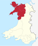
The mediaeval Welsh cantref of Arfon in north-west Wales was the core of the Kingdom of Gwynedd. Later it was included in the new county of Caernarfonshire, together with Llŷn and Arllechwedd under the terms of the Statute of Rhuddlan in 1284. The island of Anglesey faced it across the Menai Strait; to the east was the cantref of Arllechwedd, to the south the cantref of Eifionydd (which, together with Ardudwy, was part of the earlier kingdom of Dunoding), and to the west was the cantref of Llŷn. As the name suggests, Arfon faces Anglesey (Môn) (see soft mutation) across the Menai, and controls access to that strategic strait which has played an important part in Welsh history. Broadly speaking, it stretched from the peaks of Yr Eifl in the west to Afon Cegin, a stream just east of Bangor, and inland from the shores of the Menai southwards into the heart of Snowdonia (Eryri), including Dyffryn Nantlle and the strategic Llanberis Pass. In geographical terms, the cantref was very variable, including fertile land and rich pastures on the shore of the Menai and in the valleys, a number of woods on the slopes and mountains to the south, and the highest mountains in Wales such as Snowdon and Tryfan. Arfon comprised two commotes, which were apparently created later in its history: Arfon Is Gwyrfai and Arfon Uwch Gwyrfai, whose boundary was the Gwyrfai River. During the Iron Age and the Roman era, it was part of the territory of the Ordovices. The Roman fort of Segontium and the Dinorwig hill fort were located there. The main defensive fortress in the era of the Welsh princes was Dolbadarn Castle, near modern Llanberis. Important ecclesiastical centres were to be found in Bangor and Clynnog Fawr. The bishops of Bangor, the successors of St Deiniol, had an extensive holding of land in the north-east of the cantref. This was known as Maenol Bangor, but its status as an administrative unit within Arfon is uncertain. Clynnog owned broad lands in Llŷn and Anglesey. Arfon features prominently in Welsh mythology, particularly in the Fourth Branch of the Mabinogi. Math fab Mathonwy's court at Caer Dathyl was located there, as was Aranrhod's at Caer Aranrhod. The battle between the forces of Math and Pryderi took place in Arfon. Lleu Llaw Gyffes flies to Nantlleu in Arfon in the form of an eagle after his attempted murder by Gronw Pebr.A local government district of the same name existed from 1974 to 1996, when Gwynedd became a unitary authority. The name Arfon itself is still used for the area, as it has been for centuries in Wales.