Coal mining in Plymouth, Pennsylvania
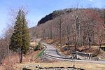
Plymouth, Pennsylvania sits on the west side of Pennsylvania's Wyoming Valley, wedged between the Susquehanna River and the Shawnee Mountain range. Just below the mountain are hills that surround the town and form a natural amphitheater that separates the town from the rest of the valley. Below the hills, the flat lands are formed in the shape of a frying pan, the pan being the Shawnee flats, once the center of the town's agricultural activities, and the handle being a spit of narrow land extending east from the flats, where the center of town is located. At the beginning of the 19th century, Plymouth's primary industry was agriculture. However, vast anthracite coal beds lay below the surface at various depths, and by the 1850s, coal mining had become the town's primary occupation.
Excerpt from the Wikipedia article Coal mining in Plymouth, Pennsylvania (License: CC BY-SA 3.0, Authors).Coal mining in Plymouth, Pennsylvania
Gaylord Avenue,
Geographical coordinates (GPS) Address Nearby Places Show on map
Geographical coordinates (GPS)
| Latitude | Longitude |
|---|---|
| N 41.242 ° | E -75.948 ° |
Address
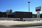
Ebenezer Baptist Church
Gaylord Avenue 39
18651
Pennsylvania, United States
Open on Google Maps


