Geißkopf (Central Black Forest)
Archaeological sites in GermanyGermanic archaeological sitesMigration PeriodMountains and hills of Baden-WürttembergMountains and hills of the Black Forest ... and 1 more
Ortenaukreis

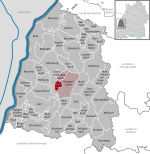
The Geißkopf is a foothill, 359 m above sea level (NHN), near Berghaupten in the south German state of Baden-Württemberg. During the Migration Period there was evidently a Roman or Germanic military camp on the strategically placed heights.
Excerpt from the Wikipedia article Geißkopf (Central Black Forest) (License: CC BY-SA 3.0, Authors, Images).Geißkopf (Central Black Forest)
Bottenbacher-Wand-Weg, Verwaltungsgemeinschaft Gengenbach
Geographical coordinates (GPS) Address Nearby Places Show on map
Geographical coordinates (GPS)
| Latitude | Longitude |
|---|---|
| N 48.417627777778 ° | E 7.974625 ° |
Address
Bottenbacher-Wand-Weg
Bottenbacher-Wand-Weg
77791 Verwaltungsgemeinschaft Gengenbach
Baden-Württemberg, Germany
Open on Google Maps


