place

Reedley Hallows

Civil parishes in LancashireGeography of the Borough of Pendle

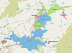
Reedley Hallows or Reedley is a civil parish in the Borough of Pendle in Lancashire, England. It forms part of Burnley and Brierfield. It had a population of 1,994, reducing to 1,960 at the 2011 Census.It is on the Leeds and Liverpool Canal, and the construction of a marina started in January 2008 and is expected to be completed in September. The local railway station, Reedley Hallows Halt on the East Lancashire Line, closed in 1956. The marina, and the site of the railway station, are both outside the current boundary of the parish, and are in an unparished area, which is part of the town of Burnley.

Excerpt from the Wikipedia article Reedley Hallows (License: CC BY-SA 3.0, Authors).

Reedley Hallows
Redman Road, Borough of Pendle Reedley

Geographical coordinates (GPS) Address Nearby Places
placeShow on map

Wikipedia: Reedley HallowsContinue reading on Wikipedia

Geographical coordinates (GPS)

Latitude Longitude
N 53.816 ° E -2.235 °
placeShow on map

Address

Redman Road

Redman Road
BB10 2LF Borough of Pendle, Reedley
England, United Kingdom
mapOpen on Google Maps

Share experience

Nearby Places

Burnley Rural District

Burnley was a Rural district of Lancashire, England from 1894 to 1974. It was named after but did not include the large town of Burnley, which was a county borough. The district and its council was created in 1894 under the Local Government Act 1894. In 1974 it was abolished under the Local Government Act 1972, with its territory going on to form part of the districts of Pendle, Ribble Valley, Burnley and Hyndburn. The offices of the Rural District Council were in Reedley Hallows, Reedley at what is now the Oaks Hotel on Colne Road. Prior to becoming the Council offices, the building was a private residence known as Oakleigh and the home of Abraham Altham. The Altham family were importers of tea and this is represented in the fine stained glass window found at The Oaks colloquially giving the building the name "Tay-Pot (or teapot) Hall". The Altham's also founded a travel agency business in 1874 which continues to trade throughout East Lancashire, the west of Yorkshire and North LincolnshireIt administered the area containing the civil parishes of Altham, Barley-with-Wheatley Booth, Blacko, Briercliffe, Brunshaw (merged with Burnley in 1911), Cliviger, Dunnockshaw, Foulridge, Goldshaw Booth, Habergham Eaves, Hapton, Heyhouses (part of Sabden after 1904), Higham with West Close Booth, Huncoat (merged with Accrington in 1929), Ightenhill, Old Laund Booth, Newchurch in Pendle, Northtown (today split between Ightenhill, Higham and Simonstone), Old Laund Booth, Read, Reedley Hallows, Roughlee Booth, Sabden (after 1904), Simonstone, Trawden, Wheatly Carr Booth (merged with Old Laund Booth in 1935), Worsthorne with Hurstwood.

Burnley built-up area

The Burnley Built-up area is an urban area or conurbation which extends from the town of Burnley to Padiham, Brierfield, Nelson, Barrowford and Colne in Lancashire, England. The area takes in parts of the boroughs of Burnley and Pendle, and also small parts of Hyndburn and Ribble Valley. It also includes a number of villages such as Blacko, Trawden and Worsthorne. In 2011 the area was recorded at having a population of 149,422. It is the third most populous urban area in Lancashire after Preston and Blackpool, with slightly more people than the urban areas of Cambridge or York. These settlements along the Leeds and Liverpool Canal expanded in the nineteenth century. The area's economy was dominated by cotton manufacturing and in the four decades after World War I the number of cotton workers reduced by over 50%. The population of approximately 187,000 in 1931, declining to 156,000 in 1961.In the 2001 census, the Burnley/Nelson urban area had a population of 149,796 and an area of 3,027 ha (11.69 sq mi). The were six sub-divisions, with 73,021 in Burnley, 28,998 in Nelson, 20,118 in Colne, 11,091 in Padiham, 10,047 in Brierfield and 5,261 in Barrowford.The built-up area defined in the 2011 census had an area of 3,572 ha (13.79 sq mi), and population of 149,422. This definition includes, at the western extremity, the predominantly industrial parts of Altham in the Borough of Hyndburn and Simonstone in the Ribble Valley. The gender makeup of the population was 73,364 male and 76,058 female. 65.1% of residents aged 16 to 74 were classed as economically active, with 2.1% long-term unemployed. The largest employment sectors were manufacturing 19.1%, wholesale and retail trade including motor vehicle repairs 17.5%, and health and social work 14.6%. The ethnic makeup of the whole urban area was 81% white and 17% Asian. Other ethnic minorities were around 2%.The Centre for Cities define a theoretical city of Burnley based on a primary urban area equivalent to the total area of the boroughs of Burnley and Pendle. In 2019 this encompassed an estimated population of 181,030 in an area of 280 km2 (110 sq mi), with an annual gross domestic product (GDP) of £5.1 billion. At 21.34%, more people are employed in the manufacturing industry than any other PUA in the UK, and it also ranks highly for the value of goods exports per job. The figure of 17.6% of the working age population with no formal qualifications is also the highest and the average weekly earnings of £402.49 is the lowest. As a result, despite having the lowest mean house price of £113,036.96, it also has the lowest housing affordability ratio.