Goat Island (Hawaii)
Geography of Honolulu County, HawaiiHawaii geography stubsIslands of Hawaii

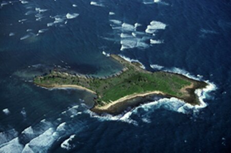
Goat Island, also known as Mokuʻauia, is a flat islet consisting of lithified dunes in Laie Bay on the northeast shore of Oahu, Hawaii. The islet is separated from Malaekahana State Recreation Area by a 720 feet (220 m) channel of limestone reef shelf 1 metre (3.3 ft) underwater.The islet is 13 acres (0.053 km2) in area with a maximum elevation of 15 feet (4.6 m).The islet is a Hawaii State Seabird Sanctuary.
Excerpt from the Wikipedia article Goat Island (Hawaii) (License: CC BY-SA 3.0, Authors, Images).Goat Island (Hawaii)
Geographical coordinates (GPS) Address Nearby Places Show on map
Geographical coordinates (GPS)
| Latitude | Longitude |
|---|---|
| N 21.6618985 ° | E -157.9244453 ° |
Address
Honolulu County
Hawaii, United States
Open on Google Maps


