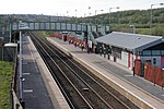
Lostock, Bolton
Areas of Bolton

Lostock is a residential district of Bolton, Greater Manchester, England, 3.5 miles (5.6 km) west of Bolton town centre and 13 miles (21 km) northwest of Manchester. Historically part of Lancashire, Lostock is bounded by Deane to the southeast, Markland Hill to the northeast, and Middlebrook to the west. Bolton Wanderers' football ground, the University of Bolton Stadium, is in nearby Horwich. After a railway station was built to serve the area in 1852, the area around the station – some 1.5 miles (2.4 km) east of Lostock Hall – became known as Lostock Junction. This name is still in use, although the station's name has changed to Lostock.
Excerpt from the Wikipedia article Lostock, Bolton (License: CC BY-SA 3.0, Authors, Images).Lostock, Bolton
Cranfield Road,
Geographical coordinates (GPS) Address Nearby Places Show on map
Geographical coordinates (GPS)
| Latitude | Longitude |
|---|---|
| N 53.58 ° | E -2.527 ° |
Address
Cranfield Road
Cranfield Road
BL6 4SB , Middlebrook
England, United Kingdom
Open on Google Maps


