place

St Cyrus National Nature Reserve

IUCN Category IINational nature reserves in ScotlandProtected areas of Aberdeenshire
St Cyrus Beach geograph.org.uk 6349

St Cyrus National Nature Reserve (NNR) is situated between the village of St Cyrus and the North Sea in the far south of the council area of Aberdeenshire in Scotland. The reserve comprises a narrow strip of land that is 3.5 km long and less than 500 m across at its widest point: the total area is 92 hectares (230 acres), most of which is only a few metres above sea level and bounded by cliffs to the west. It forms the northern third of Montrose Bay, with the River North Esk marking its southern boundary. The reserve was declared in 1962, and is managed by NatureScot. The cliffs and dunes provide a nationally important habitat for flowering plants and insects, many of which are at their northern limit in Britain. The reserve is one of the most important botanical sites on the north-east coast of Scotland, supporting over 300 plant species.A visitor centre run by NatureScot is located within an old lifeboat station, which also provides educational facilities for groups of school children, bird watchers and botanists. The centre opened in 1989 and underwent a major upgrade in 2004. As of 2008 around over 15,000 people visited the centre annually. NatureScot has waymarked a 1.5 km path known as the Tyrie Trail, and there several other paths across the reserve.

Excerpt from the Wikipedia article St Cyrus National Nature Reserve (License: CC BY-SA 3.0, Authors, Images).

St Cyrus National Nature Reserve
A92,

Geographical coordinates (GPS) Address Website Nearby Places
placeShow on map

Wikipedia: St Cyrus National Nature ReserveContinue reading on Wikipedia

Geographical coordinates (GPS)

Latitude Longitude
N 56.763801 ° E -2.4183 °
placeShow on map

Address

St Cyrus National Nature Reserve (St Cyrus NNR)

A92
DD10 0AN
Scotland, United Kingdom
mapOpen on Google Maps

Website
nnr-scotland.org.uk

linkVisit website

St Cyrus Beach geograph.org.uk 6349
Share experience

Nearby Places

Lauriston Castle, Aberdeenshire

Lauriston Castle stands on a clifftop site near the Aberdeenshire village of St Cyrus and just over a mile inland from the North Sea coast of Scotland. Once a royal fortress, it can claim to be one of the oldest privately owned and inhabited castles in the region. It is a Category C listed building.By tradition, it was the stronghold of Giric, Grig or Gregory the Great, one of the last of the Pictish kings (AD 878–889). The site of his church of Ecclesgreig (Eglise Grig) is nearby and he gave his Latin name, Ciricius, to St. Cyrus.Lauriston’s first charter is dated 1243 and it soon developed into a classic courtyard castle which was savagely fought over during Scotland's Wars of Independence and strengthened by King Edward III in 1336 as part of the chain of strongholds which he hoped would prevent a French landing in support of the Scots. One of the corner towers on the edge of the cliff was incorporated into a typical laird’s house in the 1500s. In turn, this house was absorbed into a very large Georgian mansion of Palladian design, dated 1765–89. For nearly 450 years Lauriston was held by the Stratons, whose arms of 1292 are among the earliest recorded in Scotland. The eloquent Declaration of Arbroath, the famous letter of 1320 to Pope John XXII, sealed by the nation’s earls and barons, has as its final signatory the name of Alexander Straton. Another Straton, the “noble knicht o’ Lauriston”, fell at the Battle of Harlaw in 1411, and shortly afterwards his son was involved in the affair of the Sheriff’s Kettle. The barons of the Mearns had been complaining about the high-handed behaviour of John Melville of Glenbervie, Sheriff of Kincardineshire, and King James’s Regent, the Duke of Albany, exclaimed in exasperation that he would not mind if they "biled the loon and suppit the bree". Taking this as royal licence, a group of barons lured Melville to a hunting party, tipped him into a cauldron or kettle of boiling water and, to seal the conspiracy, supped the broth.The Stratons continued, however, to prosper at Lauriston, even surviving the events of 1534, when David Straton fell out with the Church over payment of tithes on the salmon fishery. He objected to giving every tenth fish to the Abbot of Arbroath and told “his servants to cast the tenth fish into the sea againe", saying that God could catch his own. For this evasion of Church taxes he was taken to Edinburgh and condemned to death, thus becoming one of Scotland's first Protestant martyrs.In 1695, the Stratons were forced to sell Lauriston. Under the charter to the new owner, Court of Session Judge, Sir James Falconer of Phesdo, the estate became a burgh of barony, with a freeport at Miltonhaven. The name of the barony was also changed to Miltonhaven, but storms in the 1790s swept away both the port and village, leaving Lauriston to be known as “The Drown’d Barony”. Over the following century, the policies were developed in fashionable Picturesque style, with waterfalls, walks and a two-acre walled garden. Following its use as RAF barracks during World War II, part of the mansion was demolished, and according to Nigel Tranter, the castle had “fallen on evil days indeed”.Lauriston's Great Hall and Doocot Tower were rebuilt in the late 1980s by William and Dorothy Newlands of Lauriston to plans drawn up by architect Ian Begg. The doocot received a Glenfiddich Living Scotland Award in 1992.

Links Park
Links Park

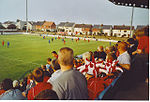
Links Park is a football stadium in Montrose, Scotland. It has been the home ground of Montrose F.C. since 1887. Links Park was opened in 1887 on land rented from the 'Auld Kirk'. To help finance the new ground, Montrose F.C. rented the pitch out for circuses and livestock grazing. The club was eventually able to raise £150 in 1920 to buy a stand, that had been previously used by the Highland Games. A roof was built over the Wellington Street end of the ground in the 1960s. Floodlights were installed in 1971 and first used in a match against Stranraer. The record attendance at the ground was 8,983, for a Scottish Cup quarter-final tie against Dundee in March 1973.Links Park was significantly improved in the 1990s, after the club was taken over by Bryan Keith. The wooden Main Stand was replaced by a cantilevered stand, seating 1,258 people. Other improvements brought the total investment to nearly £1 million, of which the Football Trust provided £400,000. Keith bought the ground in 1995 for £500,000 and granted the club a 25-year lease, without rent. GlaxoSmithKline provided a £250,000 grant in 2006 for the club to install an all-weather surface at Links Park. This pitch was replaced by another artificial surface during the 2015 close season.The current stadium capacity is 4,936. The all-seated Main Stand (South) has a capacity of 1,338 with the West Stand terrace holding a maximum of 1,582 spectators. There is also uncovered standing areas on the North and East sides off the ground. The pitch at the stadium measures 113 x 70 yards. For the 2018–19 season onwards, local junior football club Montrose Roselea have shared the ground.