place

Blow-me-down Brook

New Hampshire river stubsRivers of New HampshireRivers of Sullivan County, New HampshireTributaries of the Connecticut River

Blow-me-down Brook is a 12.8-mile (20.6 km) long stream located in western New Hampshire in the United States. It is a tributary of the Connecticut River, which flows to Long Island Sound. Blow-me-down Brook begins near the northeast border of the town of Cornish, New Hampshire, below Stowell Hill. It flows west, passing through the village of Cornish Flat, where it is joined by Notch Brook, then flows northwest into the town of Plainfield, where it takes a zig-zag course generally west, reentering Cornish shortly before its end at the Connecticut River. In Plainfield, it passes the villages of Hell Hollow and Mill Village and runs just east of Plainfield's town center. In its lower course in Cornish, the brook passes the village of Squag City and Saint-Gaudens National Historic Site. The Blow-Me-Down Covered Bridge crosses the brook at Squag City. The watershed of Blow-me-down Brook extends to Croydon Mountain (sometimes known as Grantham Mountain and as Spruce Ball by most Cornish residents) in the northwestern corner of the town of Croydon, just east of the town's boundary with Cornish. The brook was dredged from a small dam at the northeastern edge of Cornish Flat to the bridge that crosses State Route 120. This was done sometime before 1945 in order to avoid flooding.

Excerpt from the Wikipedia article Blow-me-down Brook (License: CC BY-SA 3.0, Authors).

Blow-me-down Brook
Sycamore Trail,

Geographical coordinates (GPS) Address Nearby Places
placeShow on map

Wikipedia: Blow-me-down BrookContinue reading on Wikipedia

Geographical coordinates (GPS)

Latitude Longitude
N 43.494166666667 ° E -72.379444444444 °
placeShow on map

Address

Saint-Gaudens National Historical Park

Sycamore Trail
03745
New Hampshire, United States
mapOpen on Google Maps

Share experience

Nearby Places

American Precision Museum

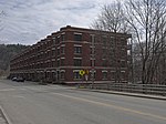
The American Precision Museum is located in the renovated 1846 Robbins & Lawrence factory on South Main Street in Windsor, Vermont. The building is said to be the first U.S. factory at which precision interchangeable parts were made, giving birth to the precision machine tool industry. In recognition of this history, the building was declared a National Historic Landmark in 1966. In 1987, the building was recognized by the American Society of Mechanical Engineers as an International Heritage Site, and the collection was recognized as an International Heritage Collection. For each of these designations, the armory was considered a site where pivotal events occurred in the history of American industry, as well as a place that lends itself to comprehensive interpretation of that history. A "machine tool" is a machine which makes parts to other machines, such as screws or gun stocks. Lathes, milling machines, and drill presses are examples of precision machine tools. The museum has the largest collection of historically significant machine tools in the United States. The museum's holdings include a collection of industrial machinery spanning the first one hundred years of precision manufacturing, along with fine examples of early machined products including rifles, sewing machines, and typewriters. Photographs and archival records provide additional resources for interpreting this critical phase of the Industrial Revolution. The museum is open daily from 10am until 5pm from May 1 through October.