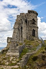
Mow Cop
Borough of Newcastle-under-LymeTowns and villages of the Peak DistrictUse British English from June 2013Villages in CheshireVillages in Staffordshire

Mow Cop is a village split between Cheshire and Staffordshire, and therefore divided between the North West and West Midlands regions of England. It is 24 miles (39 km) south of Manchester and 6 miles (9.7 km) north of Stoke-on-Trent, on a steep hill of the same name rising to 335 metres (1,099 ft) above sea level. The village is at the edge of the southern Pennines, with the Cheshire Plain directly to the west. For population details taken at the 2011 census, see Kidsgrove. The Cheshire section is the highest settlement within the county of Cheshire.
Excerpt from the Wikipedia article Mow Cop (License: CC BY-SA 3.0, Authors, Images).Mow Cop
Top Station Road,
Geographical coordinates (GPS) Address Nearby Places Show on map
Geographical coordinates (GPS)
| Latitude | Longitude |
|---|---|
| N 53.112973 ° | E -2.217582 ° |
Address
Top Station Road
Top Station Road
ST7 3NY , Odd Rode
England, United Kingdom
Open on Google Maps


