Walnut Creek (Central Texas)
AC with 0 elementsGeography of Austin, TexasGreater Austin geography stubsLandmarks in Austin, TexasProtected areas of Travis County, Texas ... and 4 more
Rivers of TexasRivers of Travis County, TexasTexas river stubsTributaries of the Colorado River (Texas)

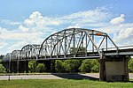
Walnut Creek is a 23-mile (37 km) long tributary stream of the Colorado River in Texas. It flows from north to south, crossing the Edwards Plateau on the western side of Austin, down to the Blackland Prairie on the eastern side of the city where it then drains into the Colorado River downstream of Longhorn Dam. The stream's upper region flows over limestone, while the southern stretch passes through deeper clay soils and hardwood forest. Walnut Creek's watershed, spanning 36,000 acres (15,000 ha), is the largest in Central Austin.The creek can be accessed at several local parks, most notably Walnut Creek Metropolitan Park and Balcones District Park.
Excerpt from the Wikipedia article Walnut Creek (Central Texas) (License: CC BY-SA 3.0, Authors, Images).Walnut Creek (Central Texas)
Austin
Geographical coordinates (GPS) Address Nearby Places Show on map
Geographical coordinates (GPS)
| Latitude | Longitude |
|---|---|
| N 30.2621 ° | E -97.6414 ° |
Address
The Woodlands
78724 Austin
Texas, United States
Open on Google Maps


