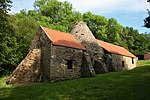
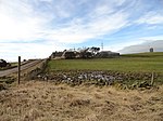
High Westwood railway station
1909 establishments in England1942 disestablishments in EnglandConsettDisused railway stations in County DurhamFormer North Eastern Railway (UK) stations ... and 5 more
North East England railway station stubsPages with no open date in Infobox stationRailway stations in Great Britain closed in 1942Railway stations in Great Britain opened in 1909Use British English from March 2017

High Westwood railway station served the village of High Westwood, County Durham, England from 1909 to 1942 on the Derwent Valley Railway.
Excerpt from the Wikipedia article High Westwood railway station (License: CC BY-SA 3.0, Authors, Images).High Westwood railway station
The Black Path,
Geographical coordinates (GPS) Address External links Nearby Places Show on map
Geographical coordinates (GPS)
| Latitude | Longitude |
|---|---|
| N 54.8992 ° | E -1.8214 ° |
Address
High Westwood
The Black Path
NE17 7QT
England, United Kingdom
Open on Google Maps


