place

Saint Bavo's Abbey

7th-century churches in BelgiumChristian monasteries established in the 7th centuryChristian monasteries in East Flanders
Sint Baafsabdij Gent, uitsnede uit kaart van Gent, 1534

Saint Bavo's Abbey (Dutch: Sint-Baafsabdij) is a former abbey in the currently Belgian city of Ghent. It was founded in the 7th century by Saint Amand, who also founded Saint Peter's Abbey, Ghent, near the confluence of the Leie and Scheldt rivers. Originally, the abbey was also called Ganda, a name of Celtic origin, meaning "river mouth", referring to the Leie river debouching into the Scheldt river. In the 9th century, the abbey was raided twice by Vikings, which made the monks flee to Laon. After an absence of nearly 50 years, they came back to Ghent and re-established the abbey. The German emperor Otto II saw the abbey as a strategical defense point on the Scheldt river (the former border between the Holy Roman Empire and West Francia) in his eternal conflict with Louis V of France. Saint Bavo Church in Aardenburg, Netherlands, was founded by monks of the abbey in 959. John of Gaunt, the fourth son of Edward III of England and father of Henry IV of England, was born in the abbey in 1340. Raphael de Mercatellis was abbot of the abbey from 1478, and used money from the abbey to commission lavish illuminated manuscripts.In 1540, Charles V ordered the destruction of the abbey. A coercion castle, with its cannons directed at Ghent, was built on the location of the abbey.

Excerpt from the Wikipedia article Saint Bavo's Abbey (License: CC BY-SA 3.0, Authors, Images).

Saint Bavo's Abbey
Gandastraat, Ghent

Geographical coordinates (GPS) Address Website External links Nearby Places
placeShow on map

Wikipedia: Saint Bavo's AbbeyContinue reading on Wikipedia

Geographical coordinates (GPS)

Latitude Longitude
N 51.0539 ° E 3.7361 °
placeShow on map

Address

Sint-Baafsabdij

Gandastraat
9000 Ghent (Ghent)
East Flanders, Belgium
mapOpen on Google Maps

Website
historischehuizen.stad.gent

linkVisit website

linkWikiData (Q1635891)
linkOpenStreetMap (227919456)

Sint Baafsabdij Gent, uitsnede uit kaart van Gent, 1534
Share experience

Nearby Places

Lys (river)
Lys (river)

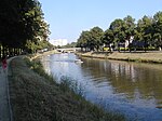
The Lys (French pronunciation: ​[lis]) or Leie (Dutch pronunciation: [ˈlɛi̯ə] (listen)) is a river in France and Belgium, and a left-bank tributary of the Scheldt. Its source is in Pas-de-Calais, France, and it flows into the river Scheldt in Ghent, Belgium. Its total length is 202 kilometres (126 mi). Historically a very polluted river from the high population density and industrialisation in both Northern France and Belgium, it has seen substantial improvements in recent years, partly due to the decline of the principal industry, the spinning and weaving of flax. The region of the Leie (between Deinze and Ghent) was known as a favourite place for numerous painters in the first half of the 20th century. The source of the Lys is in a village, Lisbourg, east of Fruges, in the Pas-de-Calais department of France. It flows generally northeast through the following departments of France, provinces of Belgium and towns and municipalities: Pas-de-Calais (F): Thérouanne, Aire-sur-la-Lys Nord (F): Merville, Armentières, Halluin Hainaut (B): Comines-Warneton West Flanders (B): Menen, Wevelgem, Kortrijk, Waregem, Wervik East Flanders (B): Zulte, Deinze, GhentThe main tributaries of the Leie are, from source to mouth: Laquette, Clarence, Lawe, Deûle, Gaverbeek, Heulebeek, and Mandel.The river was the location of three battles between the Allies and the German Army. During the First World War in 1918 the location was the scene of the First Battle of the Lys, which was part of the German Spring Offensive and later that year of the Second Battle of the Lys, which was part of the Allies' Hundred Days Offensive. During the Second World War, the Battle of the Lys was part of the 1940 German offensive in Flanders towards the English Channel.