Sooke Potholes Regional Park
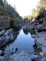
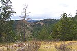
Sooke Potholes Regional Park is a 63.5-hectare (157-acre) nature park along the Sooke River, near Sooke, British Columbia. It is known for its rocky pools and canyon-like features and is a popular destination for hiking and swimming. The Land Conservancy of British Columbia (TLC) and the Capital Regional District (CRD) purchased the Sooke Potholes property from private owners in 2005 and 2007. The two organizations work together to manage, plan and develop the park's resources. The 67-site Spring Salmon Place Campground (KWL-UCHUN), located at the northern end of the park, is operated seasonally by the T'Sou-ke Nation. The smaller Sooke Potholes Provincial Park abuts the southern boundary of the regional park. The westernmost portion of the Galloping Goose Regional Trail can be accessed from the park. The Sooke Flowline, constructed in 1915, snakes through the nearby hills around the Sooke Potholes and travels all the way to the Humpback Reservoir near Mt. Wells Regional Park. It can be found east of the Sooke River.
Excerpt from the Wikipedia article Sooke Potholes Regional Park (License: CC BY-SA 3.0, Authors).Sooke Potholes Regional Park
Sooke River Road,
Geographical coordinates (GPS) Address Nearby Places Show on map
Geographical coordinates (GPS)
| Latitude | Longitude |
|---|---|
| N 48.428 ° | E -123.712 ° |
Address
Sooke Potholes Provincial Park
Sooke River Road
V9Z 0G7
British Columbia, Canada
Open on Google Maps


