place

Praze railway station

Cornwall building and structure stubsDisused railway stations in CornwallFormer Great Western Railway stationsRailway stations in Great Britain closed in 1962Railway stations in Great Britain opened in 1887
South West England railway station stubsUse British English from November 2017
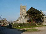
The railway used to run here geograph.org.uk 268372

Praze railway station was built to the south of the village of Praze-An-Beeble, Cornwall, England, at an elevation of 360 feet (110 m). It was an intermediate station on the single-track Helston Railway between Gwinear Road and Nancegollan, and was opened on 9 May 1887 when the line opened. The line closed on 5 October 1964 and since closure a house has been built on the site of the station and the girders and bridge deck that took the railway over the road have been removed, leaving just the brick abutments. The only other sign of a station near the village is the road name "Station Hill".

Excerpt from the Wikipedia article Praze railway station (License: CC BY-SA 3.0, Authors, Images).

Praze railway station
Station Hill,

Geographical coordinates (GPS) Address Nearby Places
placeShow on map

Wikipedia: Praze railway stationContinue reading on Wikipedia

Geographical coordinates (GPS)

Latitude Longitude
N 50.171035 ° E -5.30941 °
placeShow on map

Address

Station Hill

Station Hill
TR14 0JE , Crowan
England, United Kingdom
mapOpen on Google Maps

The railway used to run here geograph.org.uk 268372
Share experience

Nearby Places

Praze-An-Beeble

Praze an Beeble (Cornish: Pras an Bibel), sometimes shortened to Praze, is a village in Cornwall, United Kingdom. It lies between the nearby towns of Camborne (2.5 miles) and Helston (7 miles) in the civil parish of Crowan. The name Praze an Beeble was first recorded in 1697 and means the meadow of the pipe/conduit. The pipe can still be seen in the well at SW 6385 3571 opposite the entrance to the Praze medical centre. Contrary to popular belief, the village is not named after the watercourse through the village, which is called the Praze Stream, and was never historically known as the Beeble. Indeed, the upper part of it was the "Cargenwyn Stream" according to the Camborne Water Co. in 1866. It eventually joins the Red River north of Nancemellin near Gwithian. The Red River in Cornish is "Dowr Koner".Early development in the village was focused around the cross-roads, alongside which there was an inn, a smithy and two coaching houses. The buildings which housed the smithy, two cottages and the inn still remain and are Grade II listed. The settlement appears to have developed as planned, a landlord-controlled, estate village for Clowance, to supply services and housing for the mining industry in the area and also to provide housing for agricultural workers. Its main period of growth until the 20th century was between 1809 and 1840. In this part of the 19th century the rows of cottages lining the road leading north to Camborne were built. In 1897 Polsue described it as "a respectable, compact, and well-built village". Although the population of the village fell between 1881 and 1931 it has subsequently increased. Some building took place south of the village centre between 1906 and 1946, but the majority of modern development has been to the east of the original planned estate village.Praze has grown to become the largest village in Crowan parish.