place

Yantian, Shenzhen

Districts of ShenzhenYantian District
Yantian District seen from Wutong Mountain

Yantian District (simplified Chinese: 盐田区; traditional Chinese: 鹽田區; pinyin: Yántián Qū; Jyutping: Jim4tin4 Keoi1) is one of the nine districts of the city of Shenzhen, Guangdong, China. It is adjacent to Shenzhen River and Hong Kong to the south, and is surrounded by Luohu, Longgang and Pingshan districts of Shenzhen. Before 1960s, the northern part of the district belonged to Huiyang County (now Huiyang District, Huizhou). The famous Huizhou Uprising launched by Dr. Sun Yat-sen started in the northern part of the district during 1900. The failure of the revolution had inspired Dr. Sun to revolt against the Qing dynasty, which soon ended in 1912 after the Wuchang Uprising. Due to the proximity to Bao'an County, Northern Yantian merged into the new County in 1960s. In 1978, after the establishment of Shenzhen Special Economic Zone (SEZ), Yantian (as a part of Luohu District), together with several other districts in Bao'an County, formed the new special economic district. In March 1998, Yantian separated from Luohu District after the construction of Yantian Port Area of Shenzhen Port.

Excerpt from the Wikipedia article Yantian, Shenzhen (License: CC BY-SA 3.0, Authors, Images).

Yantian, Shenzhen
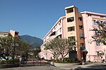
Shenyan Road, Yantian District Haishan Sub-district

Geographical coordinates (GPS) Address Nearby Places
placeShow on map

Wikipedia: Yantian, ShenzhenContinue reading on Wikipedia

Geographical coordinates (GPS)

Latitude Longitude
N 22.5637 ° E 114.24 °
placeShow on map

Address

深盐路

Shenyan Road
518000 Yantian District, Haishan Sub-district
Guangdong Province, China
mapOpen on Google Maps

Yantian District seen from Wutong Mountain
Share experience

Nearby Places

Sha Tau Kok Public Pier

Sha Tau Kok Public Pier (Chinese: 沙頭角公眾碼頭) or Sha Tau Kok Pier (沙頭角碼頭) is a public pier in Sha Tau Kok, New Territories, Hong Kong. It is located at the easternmost land border between Hong Kong and Shenzhen, China, and lies to the west of the former Sha Tau Kok Public Pier. The pier is used for loading and unloading goods and berthing of kaitos operating between Sha Tau Kok and Kat O, Sam A and other northeast rural areas. The original pier was built in the 1960s, but was replaced by a new one in 2007. Sha Tau Kok Public Pier is within the Frontier Closed Area (FCA), and remained so even after the large reduction in the size of the FCA in 2008. The government maintains a policy of issuing Closed Area Permits to area non-residents only when they can demonstrate a "genuine need" to enter the area, such as for work, business, or visiting relatives within the area. The Security Bureau conducted discussions with local residents about opening the pier to public access for decades, but expressed concern that such opening might affect security along the boundary with mainland China. Accordingly, the general public could not make use of kaitos departing from the pier for purposes of tourism to islands in Mirs Bay, and instead had to take a much longer journey from Ma Liu Shui pier via Tolo Harbour. As part of the Northern Metropolis development strategy, the government proposed to open Sha Tau Kok Public Pier to tour groups starting from mid-2022.