Sirgenstein Cave

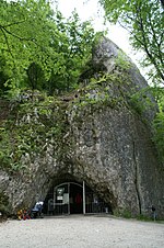
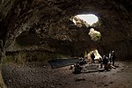
The small Sirgenstein Cave, German: Sirgensteinhöhle is situated 565 m (1,854 ft) above sea level inside the 20 m (66 ft) high Sirgenstein, a limestone rock. The cave sits 35 m (115 ft) above the Ach River valley bottom in the central Swabian Jura, southern Germany. Archaeologist R. R. Schmidt excavated the site in 1906 during which he identified indices of prehistoric human presence. He recorded the complete stratigraphic sequence of Palaeolithic and Neolithic origin. In his 1910 analysis Schmidt inspired future archaeologists with his pioneering concept of including the excavation site within its geographic region, contextualizing it within a wide scientific spectrum and demonstrated valuable results as he correlated the Sirgenstein layer structure to those of prehistoric sites in France. Mammoth ivory beads dating from 39,000 to 35,000 years ago have been uncovered at the cave. Because of its historical and cultural significance and its testimony to the development of Paleolithic art, the cave was inscribed on the UNESCO World Heritage List as part of the Caves and Ice Age Art in the Swabian Jura site in 2017.
Excerpt from the Wikipedia article Sirgenstein Cave (License: CC BY-SA 3.0, Authors, Images).Sirgenstein Cave
B 492, Gemeindeverwaltungsverband Blaubeuren
Geographical coordinates (GPS) Address Nearby Places Show on map
Geographical coordinates (GPS)
| Latitude | Longitude |
|---|---|
| N 48.386944444444 ° | E 9.7611111111111 ° |
Address
Burgrest Sirgenstein
B 492
89143 Gemeindeverwaltungsverband Blaubeuren
Baden-Württemberg, Germany
Open on Google Maps


