place

Vassar Brothers Medical Center

Hospitals in New York (state)Trauma centers

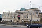
Vassar Brothers Medical Center (VBMC) (formerly Vassar Brothers Hospital) is a 350-bed not-for-profit hospital overlooking the Hudson River in Poughkeepsie, New York. It is part of the Nuvance Health healthcare network and is the major medical center in Dutchess County, New York.

Excerpt from the Wikipedia article Vassar Brothers Medical Center (License: CC BY-SA 3.0, Authors).

Vassar Brothers Medical Center
Reade Place,

Geographical coordinates (GPS) Address Phone number Website External links Nearby Places
placeShow on map

Wikipedia: Vassar Brothers Medical CenterContinue reading on Wikipedia

Geographical coordinates (GPS)

Latitude Longitude
N 41.693888888889 ° E -73.935833333333 °
placeShow on map

Address

Vassar Brothers Medical Center

Reade Place 45
12601
New York, United States
mapOpen on Google Maps

Phone number
Health Quest

call+18454548500

Website
healthquest.org

linkVisit website

linkWikiData (Q29468831)
linkOpenStreetMap (560518360)

Share experience

Nearby Places

Academy Street Historic District (Poughkeepsie, New York)

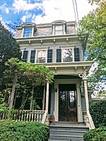
The Academy Street Historic District is a historic district located along that street between Livingston and Montgomery streets in the city of Poughkeepsie, New York, United States. It is a few blocks from US 9, just northeast of Springside, Matthew Vassar's never-completed estate that is now a National Historic Landmark. Its 140 acres (56 ha) contain 46 buildings, mostly houses, in a variety of 19th and early 20th-century architectural styles. It was the first planned neighborhood in the city.Originally part of Bronson Smith's 1805 farm, the land today part of the district was sold to a group of speculators in 1836. While the financial crisis that ensued the following year set back home construction, later on in the 19th century the purchase proved fruitful as many, many homes were built on it in a mix of styles, with houses near the north end of the district, closer to downtown Poughkeepsie, having smaller lots and yards than the ones further away. Christ Church, also built during this time, remains largely unaltered and is considered a contributing property.In the late 1970s, 85% of the residents voted in favor of establishing the district, after seeing how successful the nearby Garfield Place Historic District had been at enhancing property values and preserving that neighborhood's historic character. It was added to the National Register of Historic Places in 1982. The district designation has spurred the redevelopment and restoration of homes within and has been used as a selling point by real estate agents.Today it is one of three historic districts recognized under city zoning and subject to special architectural rules enforced by the city's Historic District and Landmark Preservation Commission (HDLPC). The HDLPC's jurisdiction over the district is not supreme; in 1986 the New York State Department of Environmental Conservation ruled that the city's Planning Board was to be lead agency and have primary jurisdiction over a proposed 18-unit condominium complex within the district.Notable former residents include William Allen Adriance (154 Academy St), farming equipment manufacturer, father of actress Jan Sterling, and founder of Adriance Memorial Library, the main public library in Poughkeepsie.

Garfield Place Historic District

The Garfield Place Historic District is a small residential neighborhood in southern Poughkeepsie, New York, United States. It is a 20-acre (8.1 ha) area covering all properties on Garfield Place, which runs for two blocks between Franklin and Montgomery streets, as well as some on nearby sections of Montgomery and Barclay. In 1972 it was listed on the National Register of Historic Places. Today's Garfield Place was originally part of a 53-acre (21 ha) area known as the "Little Commons", owned by the van Kleeck family, when Poughkeepsie was incorporated as a village in 1799. In the first decades of the new century, it grew rapidly and a man named Bronson French bought a portion of the Little Commons. In turn he sold it to a partnership of four local businessmen in 1836, who saw it as desirable for upscale homes since it was close to the center of the village and situated on a hill with commanding views of the Hudson River.They surveyed the property and subdivided it into building lots shortly afterward. At auction, the lots sold for an average of $25 per square foot. However, the Panic of 1837 slowed the economy shortly afterwards, and ground was not broken until the early 1850s when Joseph Corlies, one of the partners, built himself the house at 28 Garfield as a demonstration of what sort of home could be built on the new street.Others followed, lured by advertising that cited the quietness of the streets, the view of the river and its proximity to the growing city's downtown. By the 1880s South Liberty Street had been pretty much built out. In 1881, the street's name was changed to Garfield Place in memory of recently assassinated President James A. Garfield. The last lots would be developed in the early 20th century.The houses continued to remain among the city's most desirable addresses, and later on a carriage house originally built for Corlies' home was converted into another residence, 30 Garfield. The street's success as one of the city's first historic districts led the residents of neighboring Academy Street to seek the same status in 1982. It is subject to special architectural rules enforced by the city's Historic District and Landmark Preservation Commission (HDLPC).

Market Street Row
Market Street Row

The Market Street Row is located on the west side of that street in Poughkeepsie, New York, United States, just south of Hulme Park and across from the Adriance Memorial Library, on the southern edge of downtown. It includes three houses, including the Mott-Van Kleeck House, the oldest frame house in the city.Market Street is Poughkeepsie's oldest, in existence in 1709 when a royal decree made it part of the King's Highway, later to become the Albany Post Road after independence. The Mott-Van Kleeck House was built around 1780 by a descendant of the Van Kleeck family, one of Poughkeepsie's oldest. Stylistically it is a precursor to the Federal style, in which later decorative motifs were added. For many years it indicated the beginning of Poughkeepsie to travelers. In the late 19th century, around 1880, the two neighboring houses were built. They were ornate 2+1⁄2-story brick structures with peaked slate roofs, iron cresting, and Shingle-style porches. A tower was added to the Mott-Van Kleeck House, in sympathetic colors and materials.In the automotive era, Market Street was incorporated into US 9, the main route for drivers from New York City to Albany until the construction of the New York State Thruway and the subsequent rerouting of Route 9 onto a new expressway through the city. The houses became decrepit and were threatened during urban renewal efforts in the 1970s. They were preserved instead, and added to the National Register of Historic Places in 1982. Today they have been redeveloped into commercial offices, like the Hasbrouck House and Amrita Club nearby.

Poughkeepsie, New York

Poughkeepsie ( pə-KIP-see), officially the City of Poughkeepsie, separate from the Town of Poughkeepsie around it) is a city in the U.S. state of New York. It is the county seat of Dutchess County, with a 2020 census population of 31,577. Poughkeepsie is in the Hudson River Valley region, midway between the core of the New York metropolitan area and the state capital of Albany. It is a principal city of the Poughkeepsie–Newburgh–Middletown metropolitan area which belongs to the New York combined statistical area. It is served by the nearby Hudson Valley Regional Airport and Stewart International Airport in Orange County, New York. Poughkeepsie has been called "The Queen City of the Hudson". It was settled in the 17th century by the Dutch and became New York State's second capital shortly after the American Revolution. It was chartered as a city in 1854. Major bridges in the city include the Walkway over the Hudson, a former railroad bridge called the Poughkeepsie Bridge which reopened as a public walkway on October 3, 2009; and the Mid-Hudson Bridge, a major thoroughfare built in 1930 that carries U.S. Route 44 over the Hudson. The city of Poughkeepsie lies in New York's 18th congressional district.The City of Poughkeepsie and neighboring Town of Poughkeepsie are generally viewed as a single place and are commonly referred to collectively as "Poughkeepsie", with a combined population of 74,751 in 2018.Poughkeepsie is situated between the Lower Hudson and the Capital District regions, and the city's economy is stimulated by several major corporations, including IBM. Educational institutions include Marist College, Vassar College, Dutchess Community College and The Culinary Institute of America.

Harlow Row
Harlow Row

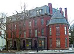
Harlow Row, also called Brick Row, is a group of brick townhouses in Poughkeepsie, New York, United States. While their address is given as 100-106 Market Street, they are actually located on a short side street referred to as Little Market Street, across from a small park with the Soldiers' and Sailors' Memorial Fountain, on the residential southern fringe of the city's downtown. The row consists of four red brick Second Empire townhouses, three stories in height with the mansard roofs typical of the style. The lower stories are rusticated, with arched doorways. An unusual Romanesque Revival tower is located on the north end.They were probably built in the 1870s by William Harlow, a former mayor of the city and architect of St. Paul's Church in the city. He may have been inspired by the attempt of another former mayor, Harvey G. Eastman, to build affordable townhouses near the park now named for him, but on a smaller scale. The row appears on city tax maps from the mid-1870s with Harlow identified as owner of the whole property. However, he was not apparently successful, since the same maps list no traceable owner of the houses themselves.In the 1880s, two local lawyers are identified as owners, and later on Charles Robinson, a liquor wholesaler. He probably added the tower sometime between 1887 and 1895. Other than some gutting of the south and west bays in 1981 to replace the windows, the houses and their period interior features remain intact. In 1982 the row was added to the National Register of Historic Places. The houses fell into disrepair in the late 20th century, one of many highly visible historic buildings in the city to do so. In 2000 Dutchess County awarded a local nonprofit, Hudson River Housing, $194,000 to rehabilitate the row into eight rental units and four commercial spaces. In 2002 the project was completed at a total cost of almost $2 million, and the company began making the units available for lease.