place

Iscoed

Country houses in CarmarthenshireGrade II listed buildings in CarmarthenshireMansel family
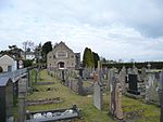
The derelict manor house of Iscoed overlooking Ferryside geograph.org.uk 1048076

Iscoed, Ferryside, Carmarthenshire, Wales is a ruined eighteenth century mansion attributed to the architect Anthony Keck. Constructed for Sir William Mansel in 1772, it was purchased by the Napoleonic general Sir Thomas Picton as an incomplete shell in 1812. The house remained the property of the Picton family until the end of the First World War. Used subsequently as council housing, it has been empty since the 1950s, and is now a derelict shell. The house is Grade II listed.

Excerpt from the Wikipedia article Iscoed (License: CC BY-SA 3.0, Authors, Images).

Geographical coordinates (GPS)

Latitude Longitude
N 51.7812 ° E -4.3451 °
placeShow on map

Address


SA17 5TP , Llandyfaelog
Wales, United Kingdom
mapOpen on Google Maps

The derelict manor house of Iscoed overlooking Ferryside geograph.org.uk 1048076
Share experience

Nearby Places

Cantref Gwarthaf (Dyfed)

Cantref Gwarthaf was the largest of the seven cantrefi of Dyfed in southwest Wales. It subsequently became part of Deheubarth in around 950. It consisted of the southeastern part of Dyfed containing most of the basin of the River Tâf, parts of modern-day Pembrokeshire and Carmarthenshire. The name means "upper-most zone". Its area was about 244 square miles (630 km2). Unlike the other Dyfed cantrefi which were divided into two (or fewer) commotes, Cantref Gwarthaf was divided into eight commotes: Amgoed, Derllys, Efelfre, Elfed, Penrhyn, Peuliniog, Talacharn, and Ystlwys. Its civil headquarters were at Carmarthen. Its ecclesiastical centre (and perhaps, in the Age of the Saints, the seat of a bishop) was probably also Carmarthen, although the churches at Llanddowror and Meidrim were also important. The cantref was made part of the Norman March in the 12th century. Marcher Boroughs were established at Carmarthen, Llansteffan, Laugharne and St Clears, and many other castles were built. The commotes of Talacharn and Penrhyn became English-speaking at the time, but was subsequently re-cymricised (except for the coastal part of Talacharn). The rest of the cantref remained Welsh-speaking, as it continues today. At the time of the Acts of Union (1535 and 1542), the cantref was split between the newly formed counties, when Efelfre became part of Narberth hundred, Pembrokeshire and the rest became part of Carmarthenshire: Amgoed, Penrhyn, Peuliniog, Talacharn, Ystlwys and part of Derllys became Derllys hundred, while Elfed and the rest of Derllys were combined with Emlyn Uwch Cuch and Gwidigada commote of Cantref Mawr to form Elfed hundred.

Castell Moel
Castell Moel

Castell Moel (also known as Greencastle, Green Castle, Humphreys Castle, or Castle Mole) is the remains of a 16th-century fortified manor house in the community of Llangain in Carmarthenshire, Wales, and also a medieval motte about 600 yards (550 m) to the south of the manor house. The remains are approximately 2.5 miles (4.0 km) south-west Carmarthen and 0.8 miles (1.3 km) north-east of the village of Llangain. Three miles to the north-west is Carmarthen Castle, and five miles to the south-west is Llansteffan Castle. In 1917 the then Royal Commission on the Ancient and Historical Monuments of Wales and Monmouthshire (now RCAHMW) described the site as "showing a few vestiges of the foundation walls of what appears to be a 14th or early 15th-century castle". The existence of Castell Moel in the 15th century is confirmed by a poem by Lewis Glyn Cothi, "I Nicolas Ryd o Castell Moel."The castle stands on a plateau overlooking the River Towy, and the overgrown remains are now thought to be of a late medieval L-plan hall house, once owned by the Rede family. The main eastern block is a first-floor hall and set in the re-entrant angle, is an adjoining high stair turret. The western block is a two-storey wing, with a porch and a cellar, and the walls of the castle, once supported a crenellated parapet. It is doubtful that the building was ever intended to be defended.The 1917 report also stated that the remains of a motte and bailey castle were easily traceable and became known as the old castle. A much more recent (sometime after 1990) visit by the Dyfed Archaeological Trust could find no trace of the older castle. The Archaeological Trust has yet to visit Old Castle. If you do, the old motte can be seen as stated in the 1917 report. The Wales Coast Path (Carmarthen to Llansteffan section) passes through the associated Green Castle Woods, a nature reserve managed by the Woodland Trust.

River Gwendraeth
River Gwendraeth

The River Gwendraeth (Welsh: Afon Gwendraeth) is a river in Carmarthenshire in West Wales. It has two almost equal branches that have their confluence in their joint estuary at Carmarthen Bay. The Gwendraeth Fawr (large Gwendraeth in English) is surprisingly the smaller and has its source in a series of springs to the north of Cross Hands, the most northerly of which rises to the north of Gorslas in the Llyn Llech Owain Country Park, just above the 585-foot (180 m) contour. Below Cross Hands, it skirts the northern edge of Mynydd Mawr Woodland Park, and flows to the south of Drefach. It crosses the 160-foot (50 m) contour to pass through Pontyberem, Pont Henri and Pontyates, by which time it is less than 33 feet (10 m) above sea level. Finally, it passes to the south of Kidwelly, to enter the estuary.The Gwendraeth Fach (small Gwendraeth in Welsh) flows further to the north having its source about 4 miles north of Cross Hands near the 190-metre (620 ft) contour at Penrhiwgoch. Passing under the A48 road, it is soon below the 160-foot (50 m) contour, flowing in a south-westerly direction to the south of Llanddarog, Cwmisfael and Llangyndeyrn, before turning southwards through Mynyddygarreg. It reaches the estuary to the west of Kidwelly after passing through the town centre.The two branches follow almost parallel courses to the sea. The valleys of both rivers flow through a mixture of modestly steep coal mining communities and through the verdant agricultural land of Carmarthenshire. When Thomas Kymer built his canal to carry coal from pits at Pwll y Llygod on the banks of the Gwendraeth Fawr to Ythyn Frenig, about half a mile to the west of Kidwelly on the southern bank of the Gwendraeth Fach, the authorising act of Parliament included powers to divert the course of the Gwendraeth Fawr from Pwll y Llygod to Pont Spwdwr, where the Kidwelly to Llanelli turnpike road crossed the river. The canal was built and operational by May 1768, and was later incorporated into the Kidwelly and Llanelly Canal. Although the route across the sands to the dock that he built was often affected by silting, it continued to be used for the export of coal long after the canal had been replaced by a railway. Coasters carried the cargo to Laugharne, Carmarthen, St Clears and Llanstephan, with the last recorded sailing bound for Llanstephan in the early 1920s.The most notable place of interest is Kidwelly Castle, perched above the estuary of the Gwendraeth Fach. The Gwendraeth estuary widens rapidly before joining with the estuaries of the River Tywi and the River Tâf to form a three-branched estuary. To the south of the estuary are the great flat sands of Cefn Sidan and Pembrey, whilst across the estuary on the banks of the River Taf is Laugharne famed for its association with Dylan Thomas. The SV Paul is one of the many shipwrecks in the vicinity of the Gwendraeth and the Cefn Sidan sands. The two points enclosing the mouth of the Gwendraeth are Salmon Point Scar (northern side) and Tywyn Point (southern side).