Bağdat Avenue (Turkish: Bağdat Caddesi, literally Baghdad Avenue) or simply Avenue (Turkish: Cadde) is a notable high street located on the Anatolian side of Istanbul, Turkey. The street runs approximately 14 km (8.7 mi) from east to west in the Maltepe and Kadıköy districts, almost parallel to the coastline of the Sea of Marmara. The most important part of the street is the one-way traffic, avenue-like section, which is 6 km (3.7 mi) long from Bostancı to Kızıltoprak, within the district of Kadıköy. It can be seen as the counterpart of Istiklal Avenue on the European side in terms of importance and glamour.
It is a main street in an upper-scale residential area. The one-way avenue with old plane trees is flanked with shopping malls, department stores, fashion garment stores, elegant shops offering world famous brands, restaurants of international and local cuisine, pubs and cafes, luxury car dealers and bank agencies. Bağdat Avenue can also be considered as a large open-air shopping mall. Most of the retail stores are open on all days of the week, including Sunday afternoon.
In summer time and on weekends, the sidewalks of the avenue are crowded with people window-shopping and youngsters lingering around. Traffic congestion is almost a standard situation on the three-lane Bağdat Avenue.
Since the 1960s street racing has been a sub-culture of the avenue, where young wealthy men tag-raced their imported muscle cars. Most of these young men are now middle-agers reliving their years of excitement as famous professional rally or track racers. With the heightened GTI and hot hatch culture starting in the 1990s, street-racing was revived in full. Towards the end of the 1990s, mid-night street racing caused many fatal accidents, which came to a minimum level thanks to intense police patrol.The neighbourhoods on the route westwards are: Cevizli, Maltepe, İdealtepe, Küçükyalı, Altıntepe, Bostancı, Çatalçeşme, Suadiye, Şaşkınbakkal, Erenköy, Caddebostan, Göztepe, Çiftehavuzlar, Selamiçeşme, Feneryolu and Kızıltoprak. The busiest and most crowded districts of Bağdat Avenue are located between Suadiye and Caddebostan (both inclusive), where most shopping malls and fashion stores are located.
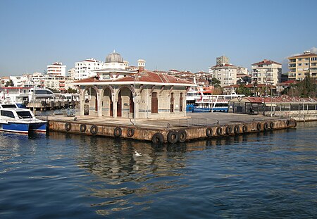
The area around Bağdat Avenue has a variety of transportation alternatives in addition to the bus and taxi options, like bicycles and scooters available for rent. There are seabus (high-speed catamaran ferry) terminals in Kadıköy and Bostancı, and a regional rail running just north of the avenue, which serves the district. Bostancı also has a quay for the traditional commuter ferries, which provide connection with the European part of the city as well as the nearby Princes' Islands.


