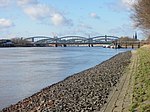
Kohlenschiffhafen
Geography of HamburgHamburg-MittePorts and harbours of Germany

Kohlenschiffhafen (Coal ship harbour) is a harbour basin of the port of Hamburg, Germany, connected with the Norderelbe anabranch of River Elbe. It is located between the promontories of Köhlbrandhöft to the west and Tollerort to the east. It marks the former mouth of the Köhlbrand anabranch into the Norderelbe.
Excerpt from the Wikipedia article Kohlenschiffhafen (License: CC BY-SA 3.0, Authors, Images).Kohlenschiffhafen
Zollpfad, Hamburg Waltershof
Geographical coordinates (GPS) Address Nearby Places Show on map
Geographical coordinates (GPS)
| Latitude | Longitude |
|---|---|
| N 53.5378 ° | E 9.9417 ° |
Address
Klärwerk Köhlbrandhöft
Zollpfad
21129 Hamburg, Waltershof
Germany
Open on Google Maps


