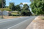
Blakiston is a town in the Australian state of South Australia. The town is located approximately 36 kilometres (22 mi) south-east of the state capital of Adelaide, adjacent to the Princes Highway. Its postal code is 5250 - though it has no post office. Post is delivered to the neighbouring town of Littlehampton which shares the post code. The town and surrounding countryside make up around 16 square kilometres. At the 2016 census, the locality of Blakiston and some adjoining land in Littlehampton had a population of 381.Blakiston has been occupied by white settlers since 1846. The town was founded by Francis Davison and named for his ancestral home, Blakiston Hall in County Durham. Its main (only) landmarks include a roadside pub and stage house (currently a private house), a cheese factory converted to a private residence, St James Church (consecrated in 1846) and neighbouring rectory, a demolished school house and the large residence of Blakiston House as well as a smaller residence. Rumour has it that the old school house was in fact demolished by rampaging cattle some time in the mid-20th century. All of these structures date from the mid to late 19th century and are constructed from a mix of pink sandstone and red brick. On the lower east wall of the Church are some small carvings of sailing ships, possibly dating back to the mid-19th century. Blakiston is surrounded by a mixture of pastureland and eucalyptus forest and includes a few other houses dating from the mid twentieth century.
Blakiston has no signs or markers indicating that it is a separate town from the close by town of Littlehampton. In fact Blakiston is in the process of being absorbed into the suburban area of Littlehampton and as a result is losing much of its individual character.


