Christians Brygge

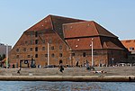
Christians Brygge (lit. "Christian's Quay") is a waterfront and street in central Copenhagen, Denmark. It runs from the mouth of Slotsholmen Canal in the north to Langebro Bridge in the south where it turns into Kalvebod Brygge. Its northern end, which is located on the small isle of Slotsholmen, is connected to Niels Juels Gade and then Holmens Kanal by Christian IV's Bridge. Christians Brygge The road section is part of Ring 2. The name refers to Christian IV, king of Denmark during the first half of the 17th century, who constructed several buildings at the site, including the Arsenal (now home to the Royal Danish Arsenal Museum) and Christian IV's Brewhouse as well as nearby Børsen. Other landmarks along the quay include the Royal Danish Library and the mixed-use building BLOX, home to the Danish Architecture Centre.
Excerpt from the Wikipedia article Christians Brygge (License: CC BY-SA 3.0, Authors, Images).Christians Brygge
Christians Brygge, Copenhagen Christianshavn
Geographical coordinates (GPS) Address Nearby Places Show on map
Geographical coordinates (GPS)
| Latitude | Longitude |
|---|---|
| N 55.6731 ° | E 12.5811 ° |
Address
Christians Brygge
Christians Brygge
1219 Copenhagen, Christianshavn
Capital Region of Denmark, Denmark
Open on Google Maps


