place

The Hollow, Bridgeport

Connecticut geography stubsNeighborhoods in Connecticut
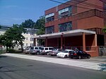
Grant Street, The Hollow, BPT MFHhomes

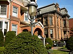
The Hollow is a neighborhood in the city of Bridgeport, Connecticut. The neighborhood is the most densely populated in the city. The neighborhood has been home to immigrants throughout its history. Approximately 30 percent of residents of the Hollow are foreign born. Sterling Hill Historic District is located in the neighborhood. The overall housing in the neighborhood is multi-family residential. The neighborhood is home to two public schools, Geraldine Johnson and Columbus school. Originally settled by Irish and English immigrants in the late 1830s, today 30% of the area's people are foreign born, and is home to Portuguese, Cape Verdean and Brazilian populations, as well as the population being 44% Hispanic.

Excerpt from the Wikipedia article The Hollow, Bridgeport (License: CC BY-SA 3.0, Authors, Images).

The Hollow, Bridgeport
Nicoll Street, New Haven

Geographical coordinates (GPS) Address Nearby Places
placeShow on map

Wikipedia: The Hollow, BridgeportContinue reading on Wikipedia

Geographical coordinates (GPS)

Latitude Longitude
N 41.321 ° E -72.907 °
placeShow on map

Address

mActivity

Nicoll Street
06511 New Haven
Connecticut, United States
mapOpen on Google Maps

Grant Street, The Hollow, BPT MFHhomes
Share experience

Nearby Places

Upper State Street Historic District

The Upper State Street Historic District encompasses a well-preserved neighborhood commercial district of the late 19th century in the East Rock neighborhood of New Haven, Connecticut. The district is an irregular strip running NNE to SSW mainly along State Street in New Haven (between Bradley Street and the Mill River), one block west of Interstate 91, the highway which determines the district's eastern and southern borders. The district was listed on the U.S. National Register of Historic Places in 1984.When New Haven's core area was laid out in the 1630s, what is now State Street started out as a path from that area to a series of meadows along the Mill River that were used as pasture land. A bridge spanned the Mill River in 1641, cementing the roadway's importance as an east–west travel route. It saw no significant commercial development, however, until after 1850, when the rapidly industrializing city began expanding into the area. By the 1890s the street had been almost fully developed as a neighborhood commercial center, serving the large residential area traversed by Orange Street and Whitney Avenue to the west.Most of the buildings lining State Street date to this first period of development. They are architecturally and functionally diverse, including commercial buildings, mixed-use commercial/residential buildings, light industrial buildings, and churches. Many of the commercial buildings have retained original features of their storefronts. Only a small number of buildings from that period have been demolished, and the surrounding streetscape suffered from the construction of Interstate 91 in the mid-20th century.

Worthington Hooker School

Worthington Hooker School (WHS) is a public elementary and middle school in New Haven, Connecticut, United States. It is part of the New Haven Public Schools district and is named after former Yale University professor and physician Dr. Worthington Hooker (1806–1867). It serves students from kindergarten through eighth grade in two separate buildings for its elementary and middle school provision. The school also reports the highest achievement of the city's K-8 public schools.The original school building at 180 Canner Street, which now houses the lower school, was erected in 1900. It currently houses kindergarten through grade 2. As this school building was not large enough to encompass all nine grades, grades 3-8 were formerly located in the former Saint Stanislaus School building at 804 State Street. As of summer 2007, renovations of the main school building had been completed and efforts were under way to build a new 60,000-square-foot (5,600 m2) school building for the middle school on nearby Whitney Avenue. Planned construction of the new middle school was delayed for several years due to opposition by neighbors who objected to the use of "spot zoning" to allow construction of a school in a residential neighborhood and sued to block the project. An August 2007 unanimous decision by the Connecticut Supreme Court allowed the project to proceed, based on a finding that the city had not abused its zoning authority. The new middle school building for grades 3 through 8 was completed in 2009 at a cost of $36.5 million and officially opened on December 21, 2009.The 180 Canner Street building is a contributing property in the Whitney Avenue Historic District, listed on the National Register of Historic Places.

Whitney Avenue Historic District

The Whitney Avenue Historic District is a historic district in the East Rock neighborhood of New Haven, Connecticut. It is a 203-acre (82 ha) district which included 1,084 contributing buildings when it was listed on the National Register of Historic Places in 1989. It is bordered by Edgerton Park and East Rock Park on the north. It abuts the Prospect Hill Historic District to the west and the Orange Street Historic District on the east. Yale University facilities border on the southwest and south.: 59  The district is named after Whitney Avenue, the principal thoroughfare in the district, which is lined with mansions or other larger houses, while the smaller streets included in the district have mostly smaller homes. Per its NRHP nomination, the district is significant as a well-preserved middle and upper-class residential neighborhood which reflects the process of suburbanization in New Haven during the late 19th and early 20th centuries...and which has retained its integrity with few intrusions or alterations.... The houses in the district embody the distinctive characteristics of several periods and types of domestic architecture, including locally outstanding examples of Queen Anne, Shingle, Colonial Revival, Tudor Revival, and other styles....: 51  The district includes 749 "major" buildings: mostly houses but also schools, small commercial buildings, and a firehouse. Including smaller outbuildings such as garages and carriage houses, there were a total of 1,113 buildings in 1989. Besides the 1,084 contributing buildings, the district then included 29 non-contributing buildings.: 1  Since that time, some of the contributing buildings have been demolished, such as some garages behind houses, but the character of the district is generally preserved.

Orange Street Historic District

The Orange Street Historic District encompasses a large residential in the East Rock section of New Haven, Connecticut. Roughly bounded by Orange, Cottage, Eagle, State, and Audubon Streets, this area saw growth between about 1830 and 1900, and includes a broad diversity of well-preserved 19th-century residential structures. It was listed on the U.S. National Register of Historic Places in 1985. At that time, it included 546 buildings deemed to contribute to the historic character of the area.New Haven's early economy was based mainly on trade based around its port. In the 1820s, the Farmington Canal opened, spurring a round of industrial development that was accompanied by population growth. The Orange Street area, located northeast of the New Haven Green, was one of the areas that saw significant development during this period. Around 1850, the city became a railroad transportation hub, and its industrial base expanded significantly. Residential growth in the Orange Street area expanded beyond Clark Street, into an area that was until 1850 farmland.The district is an irregularly shaped area bounded on the northwest by Orange Street, between Audubon and Cottage Streets. The northwestern half of Orange Street is included in the Whitney Avenue Historic District, which abuts the Orange Street Historic District on the west. The southeastern boundary is State Street, although no buildings facing State Street are included. Most of the buildings in the district are residential, and are of wood-frame construction. They are stylistically diverse, with representative examples of styles from the late Federal period of the 1820s to the Colonial Revival of the early 20th century.

Atwater–Ciampolini House

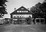
The Atwater–Ciampolini House, also known as the Charles Atwater House, is located at 321 Whitney Avenue in New Haven, Connecticut, at the southwest corner of intersection with Edwards Street. It is an important example of Shingle style architecture. It was designed by New York City-based architects Babb, Cook and Willard and was built during 1890-92. For many years the property had served as offices for Thompson and Peck, an insurance agency. The house was documented by the Historic American Buildings Survey with photographs taken in 1964, 1967, and 1970, and it is a contributing property in the Whitney Avenue Historic District that was listed on the National Register of Historic Places in 1989. According to HABS documentation, the building is discussed and illustrated in Vincent J. Scully, Jr.'s The Shingle Style (1955, Yale University Press). That book is one of the principal documents of the Shingle style. The house has gable front, strip windows, and a shingled exterior. The house is two and a half stories tall. A two-story addition at the rear was added in 1969; the architect for the addition was Henry Miller.In the 1988 nomination of the Whitney Avenue Historic District, the house was described as follows: The Charles Atwater House of 1890 at 321 Whitney Avenue, recalls McKim, Mead and White's William Low House of Bristol, Rhode Island, of 1887 in its low, spreading roof and banded fenestration with windows separated by panels; it was designed by the nationally renowned firm of Babb, Cook and Willard.: 55  In 1890 the deed was put into the name of Helen G. Atwater, wife of Charles Atwater, when the property was purchased from previous owners. Charles apparently died in 1916 and Helen remarried to Ettore Ciampolini in 1922. The house was purchased by Thompson and Peck in 1968. Today, the Atwater–Ciampolini House serves as the law offices of Balzano & Tropiano, P.C., trial lawyers.