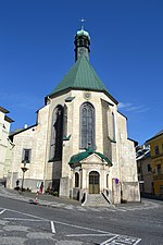
Banská Štiavnica District
Banská Bystrica Region geography stubsBanská Štiavnica DistrictDistricts of Slovakia

Banská Štiavnica District (Slovak: okres Banská Štiavnica; Hungarian: Selmecbányai járás) is a district in the Banská Bystrica Region of central Slovakia. Until 1920, most of the present-day district belonged to the county of Kingdom of Hungary of Hont, apart from Močiar and Podhorie in the north (Tekov) and Kozelník in the east (Zvolen county).
Excerpt from the Wikipedia article Banská Štiavnica District (License: CC BY-SA 3.0, Authors, Images).Banská Štiavnica District
Radničné námestie,
Geographical coordinates (GPS) Address Nearby Places Show on map
Geographical coordinates (GPS)
| Latitude | Longitude |
|---|---|
| N 48.458611111111 ° | E 18.893055555556 ° |
Address
Radničné námestie 107/14
969 01 (Banská Štiavnica)
Region of Banská Bystrica, Slovakia
Open on Google Maps


