place

Llanwern

Communities in Newport, WalesUse British English from August 2019
Church of St Mary, Llanwern geograph.org.uk 1449730

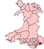
Llanwern is a community in the eastern part of the City of Newport, South East Wales. Llanwern is bounded by the M4 and Langstone to the north, Ringland, Lliswerry and the River Usk to the west, the River Severn to the south and the city boundary to the east. The population of the Llanwern community in 2011 was 333, which contains Llanwern village and the western half of the site of Llanwern steelworks. The area is governed by the Newport City Council. The community population dropped to 289 in 2011. The community also includes the area of Glan Llyn.

Excerpt from the Wikipedia article Llanwern (License: CC BY-SA 3.0, Authors, Images).

Llanwern
Queen's Way, Newport Llanwern

Geographical coordinates (GPS) Address Nearby Places
placeShow on map

Wikipedia: LlanwernContinue reading on Wikipedia

Geographical coordinates (GPS)

Latitude Longitude
N 51.57201 ° E -2.91331 °
placeShow on map

Address

Queen's Way

Queen's Way
Newport, Llanwern
Wales, United Kingdom
mapOpen on Google Maps

Church of St Mary, Llanwern geograph.org.uk 1449730
Share experience

Nearby Places

Magor and St Mellons Rural District

Magor and St Mellons Rural District was created on 1 April 1935 from Magor Rural District and St Mellons Rural District in the administrative county of Monmouthshire. The district was a mixture of suburban and semi-rural parishes around Newport and had its headquarters in Baneswell, Newport. It comprised the parishes of Bettws, Bishton, Coedkernew, Duffryn, Goldcliff, Graig, Henllys, Kemeys Inferior, Langstone, Llandevenny, Llanmartin, Llanwern, Llanvaches, Machen Lower, Magor, Marshfield, Michaelstone-y-Fedw, Nash, Penhow, Peterstone Wentloog, Rogerstone, Rumney, St Brides Wentloog, St Mellons, Redwick, Whitson and Wilcrick. In 1938 the parish of Rumney was removed from the Rural District to become part of the county borough of Cardiff, in the neighbouring county of Glamorgan, although it remained part of Monmouthshire. The Rural District Council comprised a number of councillors and a chairman. Its responsibilities included sanitary services, sewerage, refuse collection, maintaining local roads, cemeteries and parks, licensing of public entertainments, water supply and housing. The council was administered by a number of committees and by appointed officers including a Clerk, Treasurer, Medical Officer of Health, Surveyor and Sanitary Inspector. The headquarters were in Baneswell, Newport. Magor and St Mellons Rural District was abolished in 1974, with Henllys becoming part of the Torfaen district (borough) and St Mellons becoming part of the City of Cardiff. The remaining majority of the district became part of the Borough of Newport. The Mayor of Newport's Mayoral Chains of Office carry the medallion of the Magor and St Mellons Rural District to show this historic association.