Willoughby River
Geographic coordinate listsLists of coordinatesOrleans County, VermontRivers of VermontUse mdy dates from April 2017 ... and 1 more
Vermont geography stubs
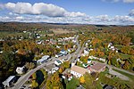
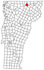
The Willoughby River ( WIL-ə-bee) is a tributary of the Barton River, flowing on 18.6 km (11.6 mi), in the Orleans County, Vermont, United States.This river flows to northwest, southwest and northwest, crossing the municipalities of Westmore, Vermont, Orleans and Brownington. Its course runs through forested areas, agricultural and urban.
Excerpt from the Wikipedia article Willoughby River (License: CC BY-SA 3.0, Authors).Willoughby River
Maple Street,
Geographical coordinates (GPS) Address Nearby Places Show on map
Geographical coordinates (GPS)
| Latitude | Longitude |
|---|---|
| N 44.8175 ° | E -72.203888888889 ° |
Address
Maple Street
Maple Street
05860 (Orleans)
Vermont, United States
Open on Google Maps


