place

Salisbury Fish Hatchery

Buildings and structures completed in 1931Buildings and structures in Salisbury, VermontFish hatcheries in the United StatesGovernment buildings on the National Register of Historic Places in VermontHistoric districts on the National Register of Historic Places in Vermont
NRHP infobox with nocatNational Register of Historic Places in Addison County, VermontUse mdy dates from August 2023
SalisburyVT FishHatchery2

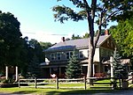
The Salisbury Fish Hatchery is a state-operated fish hatchery on Vermont Route 53 in Salisbury, Vermont. Established in 1931, it produces broodstock trout for distribution to the other hatcheries in the state. Its facilities were listed on the National Register of Historic Places in 1994. The facility may be toured by arrangement, but there is no visitors center.

Excerpt from the Wikipedia article Salisbury Fish Hatchery (License: CC BY-SA 3.0, Authors, Images).

Salisbury Fish Hatchery
Lake Dunmore Road,

Geographical coordinates (GPS) Address Nearby Places
placeShow on map

Wikipedia: Salisbury Fish HatcheryContinue reading on Wikipedia

Geographical coordinates (GPS)

Latitude Longitude
N 43.924722222222 ° E -73.096388888889 °
placeShow on map

Address

Lake Dunmore Road 645
05769
Vermont, United States
mapOpen on Google Maps

SalisburyVT FishHatchery2
Share experience

Nearby Places

Lake Dunmore
Lake Dunmore

Lake Dunmore is a freshwater lake in Addison County, Vermont. The lake spans the towns of Salisbury and Leicester and has a surface area of 985 acres (3.98 km2). Lake Dunmore is over 3 miles long (oriented north-south) and up to 1 mile wide. The primary source of water is Sucker Brook, which rises in the adjacent Moosalamoo National Recreation Area of the Green Mountain National Forest. The lake is drained by Leicester River, a tributary to Otter Creek, which in turn empties into Lake Champlain. Branbury State Park occupies 69 acres (28 hectares) of the eastern shore and offers a sandy beach, canoe rentals, and campsites. Vermont Route 53 follows the eastern and northern shores of the lake. Most of the shoreline is privately owned. Keewaydin (camp) operates two camps on Lake Dunmore. Keewaydin Dunmore for boys was established in 1910. Songadeewin, a camp for girls, was established in 1999.Point CounterPoint, a chamber music camp established in 1963, operates on the western shore of Lake Dunmore.The Lake Dunmore/Fern Lake Association, Incorporated "protects the Lakes’ value as a public recreational facility and respects the interests of property owners and the public".Although a natural lake formed by glaciation, the water level is controlled by a small dam. In addition, Sucker Brook is part of a hydroelectricity project connecting Silver Lake and Sugar Hill Reservoir via Sucker Brook and operated by Green Mountain Power.There have been conservation efforts to protect the loons who nest on Lake Dunmore. In 2022, Mike Korkuc was awarded the Green Mountain Power-Zetterstrom Environmental Award for his Loon recovery conservation work at Lake Dunmore.

Green Mountain National Forest

Green Mountain National Forest is a national forest located in Vermont, a temperate broadleaf and mixed forest typical of the New England/Acadian forests ecoregion. The forest supports a variety of wildlife, including beaver, moose, coyote, black bear, white-tailed deer, wild turkey, and ruffed grouse. The forest, being situated in Vermont's Green Mountains, has been referred to as the granite backbone of the state. Established in 1932 due to uncontrolled overlogging, fire and flooding, the forest originally consisted of 102,100 acres (413 km2); however, only 1,842 acres (7.45 km2) were federally owned, while the remaining 100,258 acres (405.73 km2) within the national forest boundary were not federally owned or administered. As of 2011, the forest boundaries included 821,040 acres (3,322.6 km2), of which 399,151 acres (1,615.31 km2) were federally owned and administered. GMNF is one of only two national forest areas in New England, the other area being the White Mountain National Forest in New Hampshire. In descending order of land area, GMNF is located in parts of Bennington, Addison, Rutland, Windham, Windsor, and Washington counties. The forest headquarters are in Mendon, Vermont, alongside those of Finger Lakes National Forest though that forest is in New York state.The forest contains three nationally designated trails, including parts of the Appalachian Trail and the Long Trail, as well as the Robert Frost National Recreation Trail. The forest also includes three alpine ski areas, seven Nordic ski areas, and approximately 900 mi (1,400 km) of multiple-use trails for hiking, cross country skiing, snowmobiling, horseback riding, and bicycling.The forest benefited from the American Reinvestment and Recovery Act of 2009. Forest revenue is generated by recreation fees (such as at Mount Snow, Stratton Mountain and Bromley Mountain ski areas) and timber sales. About 42 acres (17 ha) were set aside for forest regeneration in 2009. Planned expenditures include road construction, recreation and heritage, and wildlife management. Projects in the latter category include: land/water modification in support of ruffed grouse, wild turkeys, bear, trout, salmon, Bicknell's thrush, and the plant Jacob's ladder. The emerald ash borer is a threat to Vermont's trees.

East Middlebury, Vermont

East Middlebury is a census-designated place in the town of Middlebury, Addison County, Vermont, United States. Its population was 425 as of the 2010 census.East Middlebury first came to the attention of settlers from English America after the French and Indian War. The charter that created Middlebury dates from 1761 and the earliest settlement in East Middlebury dates from 1775 when Ebar Evarts cleared land for the construction of a tavern, the forerunner of today’s Waybury Inn. Jonathan Foot began the development of the area of the Middlebury River Gorge in 1790. The development of the village was encouraged by its location at the west end of the trail over the Green Mountains as it entered into the Otter Creek Valley. The Middlebury River Gorge was also a prime area for waterpower for mills located along its banks. The first mill of many built in the town, was a sawmill on the south side of the river near the top of gorge. This area was also the site of The East Middlebury Iron Works (1831-1890) and was the last iron works in Vermont to close its doors. The river also powered a grist mill, a wool finishing mill, and a tannery. In 1810, Jonathan Foot built a “place of entertainment” (the Waybury) that also served as a stagecoach stop for traffic coming over the mountain pass. By 1812 the village had added a general store. Epaphras Jones, who had established the Vermont Glass Factory Company at Lake Dunmore, built another glass production facility in East Middlebury in 1814. The building was a circular brick construction located just west of the Waybury and across the street (the site of St. Barnabas Chapel. In 1821, the community had ten dwellings, an Inn, and a few shops. Growth continued, so that in 1850 there were 50 homes in the village. Norman Tupper built a grist mill further south on the river. This facility was purchased by the Brown Novelty Company in 1915 for making wooden toys. It is believed that the former Episcopal Rectory (Partridge House) is the oldest dwelling house in the village. It may be the original house built by Jonathan Foot. The Foote/Zahn’s house was the house built by Epaphras Jones, who had his glass factory just across the street from the dwelling.Established by statute, the East Middlebury Prudential Committee is an independently-elected legislative body (unaffiliated with the Middlebury Selectboard) that governs East Middlebury's Fire District #1 and manages the East Middlebury water system. Among its duties, the Prudential Committee establishes water rates for residents and businesses in East Middlebury. As factories and small businesses have left East Middlebury, it continues to be a place next to the river and below the Green Mountains. The village has had major floods (1928, 1937, 2011).