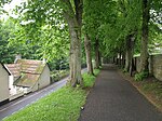
Poundbury Hill

Poundbury Hill (grid reference SY682911) is the site of a scheduled Prehistoric and Roman archaeological remains and includes evidence of a Neolithic settlement, a substantial Bronze Age occupation site and an Iron Age hillfort. There are also late Iron Age burials and a section of Roman aqueduct. On the eastern side is an earlier Romano-British farmstead; and an extensive later (possibly Christian) cemetery, belonging to the Roman town Durnovaria. Further buildings and enclosures of the 5th-8th centuries overlie the Roman cemetery. It is roughly rectangular and it is likely that it was designed to command views over the River Frome and the Frome valley to the north. The main entrance to the fort is on the eastern end. It overlooks the county town of Dorchester, Dorset, England.
Excerpt from the Wikipedia article Poundbury Hill (License: CC BY-SA 3.0, Authors, Images).Poundbury Hill
Normandy Way,
Geographical coordinates (GPS) Address External links Nearby Places Show on map
Geographical coordinates (GPS)
| Latitude | Longitude |
|---|---|
| N 50.71865 ° | E -2.45182 ° |
Address
Poundbury Hill Fort
Normandy Way
DT1 2PP , Poundbury
England, United Kingdom
Open on Google Maps


