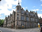
City of Lancaster
Boroughs in EnglandCities in North West EnglandCity of LancasterNon-metropolitan districts of LancashirePages with non-numeric formatnum arguments ... and 1 more
Use British English from March 2015

The City of Lancaster () is a local government district of Lancashire, England, with the status of a city and non-metropolitan district. It is named after its largest settlement, Lancaster, but covers a far larger area, which includes the towns of Morecambe, Heysham, and Carnforth, as well as outlying villages, farms, rural hinterland and (since 1 August 2016) a section of the Yorkshire Dales National Park. The district has a population of 142,934 (2021), and an area of 222.5 square miles (576.2 km2).
Excerpt from the Wikipedia article City of Lancaster (License: CC BY-SA 3.0, Authors, Images).City of Lancaster
Spring Garden Street, Lancaster Greaves
Geographical coordinates (GPS) Address Website Nearby Places Show on map
Geographical coordinates (GPS)
| Latitude | Longitude |
|---|---|
| N 54.047 ° | E -2.801 ° |
Address
Ibis Budget Lancaster Centre
Spring Garden Street
LA1 1RQ Lancaster, Greaves
England, United Kingdom
Open on Google Maps


