place

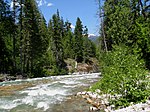
Hutchinson Creek

Rivers of Washington (state)Rivers of Whatcom County, WashingtonWashington (state) river stubs

Hutchinson Creek is a stream in the U.S. state of Washington.Hutchinson Creek was named after one Mrs. Hutchinson, a pioneer settler.

Excerpt from the Wikipedia article Hutchinson Creek (License: CC BY-SA 3.0, Authors).

Geographical coordinates (GPS)

Latitude Longitude
N 48.706388888889 ° E -122.17888888889 °
placeShow on map

Address

Saxon


98220
Washington, United States
mapOpen on Google Maps

Share experience

Nearby Places

Independence County, Washington

Independence County was a proposed county to be created from the northwest corner of Whatcom County, Washington. The proposal had the most momentum in the county elections of 1993, when secessionist interests won a majority of votes on the County Council. The Independence County proposal, like other county secession proposals in Washington, was organized by construction and development interests (under the banner of property rights), hoping that a separate county would redefine county zoning and land use plans to encourage new development. Proponents of the new county took advantage of rural landowners' perception of tax flow: that property taxes had increased unreasonably in order to foot the bill for infrastructure development in the county seat of Bellingham, Washington. This assertion was bolstered by studies on three of Washington's county creation proposals (including Independence) undertaken by UW Professor Richard Zerbe, but refuted by Whatcom County Assessor Keith Wilnauer. In 1994 the Independence County movement was based in Deming, Washington, organized by Doug Howard, a preacher, retail landowner, and mortgage lender. The Independence movement had ties to the Wise Use Movement, and anti-environmental interest group. The Independence movement also had ties to other county secession movements in Washington including Freedom, Pioneer, and Skykomish county proposals. Petitions to propose that Independence County be created were circulated around the proposed area between 1993 and 1994. Many signatories believed that they were signing an initiative to be placed on an upcoming ballot, but it was only a petition to the legislature. After the Washington State Public Disclosure Commission secured a disclosure hearing into the lobbying actions and finances of the organized Cedar County, Washington movement, the Independence County organized movement (as well as those of other Washington county secession movements) shut down in 1994.

Whatcom Trail
Whatcom Trail

The Whatcom Trail was an overland trail from the Puget Sound area of Washington Territory during the Fraser Canyon Gold Rush of 1858. The trail began on Bellingham Bay, at Fairhaven (now a Bellingham neighbourhood), the route used went via a route known as the Columbia Valley, which is a lowland route connecting the mid-Nooksack River area with Cultus Lake and the lower Chilliwack River in the Upper Fraser Valley, about 80 km east of today's Vancouver. In 1858, T. G. Richards built the first brick building in Washington as an outfitter for those using the Whatcom Trail. The name "Whatcom" comes from the Lummi place name x̣ʷátqʷəm, probably meaning "noisy" with reference to a waterfall.A more westerly route now in use for a major border crossing (at Sumas) was not usable due to the presence of Sumas Lake, a large shallow lake, now drained and turned into agricultural land. An alternate route to the main Whatcom Trail was the Skagit Trail, which went up the river of that name to its headwaters, from which another "back valley" emerges on the Fraser near Hope, then the HBC fur trading post Fort Hope. There are no known statistics for the number of goldseekers who travelled the Whatcom Trail during the gold rush, although certainly they may be counted in the thousands. Its existence was in open defiance of the edict from the British Governor on Vancouver Island that access to the Fraser goldfields must be made from Victoria, and then from there via the Fraser River only. In part this measure was intended to prevent the entry of large parties of armed Americans, and also to strip them of any handguns and any goods for trading with the Indians (still a Hudson's Bay Company monopoly during the gold rush). The route's ongoing use was demonstration of the early colony's essential inability to prevent unregulated intrusion by US citizens, as was also the case with the Okanagan Trail. US troops of the Border Commission who were stationed near the route's southern US end were put on alert during the McGowan's War crisis, and were also stationed there during the San Juan Islands Dispute (the Pig War). Similarly, on the Canadian side, the large tract of land in Sardis that for many years was Canadian Forces Base Chilliwack was laid aside as a military reserve during the scare over potential Fenian Raids in the 1870s and 1880s. That allocation, however, was as much a response to local Stó:lō First Nations numbers as it was to potential American aggression. There is no border crossing at the Columbia Valley today, only a fence across farmland.