Rigensgade
Streets in Copenhagen

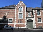
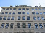
Rigensgade (lit. "State Street") is a street in central Copenhagen, Denmark. It links Sølvgade in the west with Øster Voldgade in the east. An underpass for pedestrians link the beginning of the street with Rosenborg Castle Gardens on the other side of Sølvgade. Notable buildings include the former Garrison Hospital. and the Methodist Jerusalem's Church.
Excerpt from the Wikipedia article Rigensgade (License: CC BY-SA 3.0, Authors, Images).Rigensgade
Rigensgade, Copenhagen Indre By
Geographical coordinates (GPS) Address Nearby Places Show on map
Geographical coordinates (GPS)
| Latitude | Longitude |
|---|---|
| N 55.6883 ° | E 12.5835 ° |
Address
Rigensgade
Rigensgade
1316 Copenhagen, Indre By
Capital Region of Denmark, Denmark
Open on Google Maps


